Pointe-Taillon National Park, Nature reserve on the north shore of Lake Saint-Jean, Quebec.
Pointe-Taillon is a nature reserve on the north shore of Lake Saint-Jean covering lowland areas with sandy beaches and diverse wetland zones. The landscape features marshy areas, sand dunes, and forested sections that create a natural transition between the water and the inland forest.
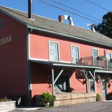
The sandy point was first nicknamed Pointe Savane and later named for Louis-Olivier Taillon, premier of Quebec for four days in 1886 and again from 1892 to 1896. From 1890 to 1930 the peninsula was farmed; Sainte-Jeanne-d'Arc was incorporated in 1916 and the point peaked at 307 inhabitants in 1925. In 1926, closing the Isle-Maligne dam gates flooded the best farmland, which Alcan bought up; reforestation followed in 1948 and 1956. The government acquired the land in 1977 and created the park on 6 November 1985.
The point was farmed from 1890 to 1930; at its peak in 1925 it had 307 inhabitants, and Île Bouliane, owned by Frenchman Paul-Augustin Normand, was a farm with over 125 employees that won agricultural awards. The park is named after Louis-Olivier Taillon, premier of Quebec for four days in 1886 and again from 1892 to 1896.
There are no roads inside the park, so access to the peninsula is on foot or by bike; the 45 km cycling network includes 16 km of the Route verte. Since 2022, 18 campsites are spread over three small islands, reachable by bike or by boat. The point's relief is almost flat, which makes distances easy to cover.
The peninsula is a post-glacial delta built 7,000 to 5,000 years ago from deposits of the Péribonka River, and its flat sandy relief hides a huge bog at the centre, ringed by swamps and wetlands. Moose and beavers are abundant there.
The community of curious travelers
AroundUs brings together thousands of curated places, local tips, and hidden gems, enriched daily by 94,132 contributors worldwide.