Lake Lauerz, Lake in Schwyz District, Switzerland
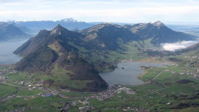
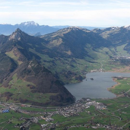
Lake Lauerz lies in the Schwyz basin between the Rossberg and the Rigi, at 447 m above sea level. Its water area varies between 310 and 360 ha, with a maximum depth of 14 m. The irregular lake has two small islands near its southern shore: Schwanau (5,728 m²) and the uninhabited Roggenburg (750 m²). A tectonic ridge divides it into two basins.
In 1806 a large landslide from the Rossberg mountain sent debris into the lake and triggered a wave that destroyed parts of the shoreline and flooded nearby villages. The event changed the shape of the lake bed permanently and left traces that are still visible in the surrounding landscape today.
The lake's name comes from the village of Lauerz on its southern shore; an older spelling was Lowerzer See. The two islands, Schwanau (5,728 m²) and the uninhabited Roggenburg (750 m²), both belong to the municipality of Lauerz. In winter, when the lake freezes, gas bubbles form under the ice and local youths have for decades set them alight through holes cut in the ice.
The shoreline can be reached on foot from the villages of Lauerz and Steinen, where paths run close to the water. Footwear with a good grip is helpful, as parts of the trail can become slippery after rain.
The floor of the lake still holds a thick layer of debris from the 1806 landslide, buried under the water and largely out of sight. Divers who have explored the area have found the remains of structures that were swallowed by the flood that year.
The community of curious travelers
AroundUs brings together thousands of curated places, local tips, and hidden gems, enriched daily by 94,592 contributors worldwide.