Chest opened
+${chestReward.xp} XP
Explorer
NOUVEAU ×${chestReward.collectible.quantity}
tapez pour fermer

See the monuments around you in AR Open chests in the app

Around Us is built for your phone — point your camera at the streets and discover the monuments and places around you in augmented reality. Around Us is built for your phone — chests unlock when you walk, explore and capture nearby places.

•

Enable Location

We need your location to show you interesting places around you

Discover nearby places

Find interesting locations and hidden gems around you

Precise directions

Get accurate directions and distances to places

Your location is never shared with other users. It's only used when you tap the location button.

Blinnenhorn

Log in to your account

Start exploring — it's free

Trusted by 93,662 travelers worldwide

Continue with Google
Continue with Apple
or

We will send you a code to connect

By continuing, you accept our Terms and Conditions and our Privacy Policy

Check your inbox

We've sent a pincode in your inbox. Please enter the code below.

Blinnenhorn

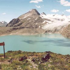
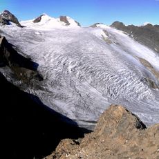
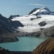
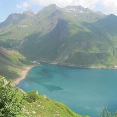
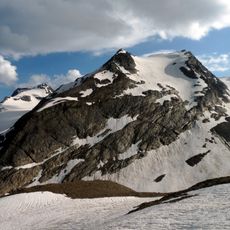
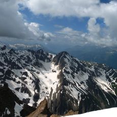
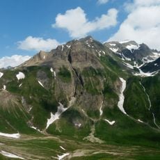
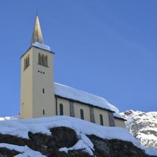
Blinnenhorn, Alpine summit in Lepontine Alps, Switzerland

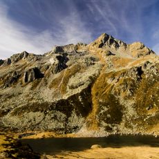
Corno Cieco is a 3374-meter alpine summit in the Lepontine Alps on the border between Switzerland and Italy. The mountain has a northern subsidiary peak, Klein Blinnenhorn, standing at 3215 meters.

The mountain was first documented in 1881 when British painter and mountaineer Arthur Cust reached the summit in autumn. This ascent marked the beginning of Alpine exploration in this region.

The name Blinnenhorn is German, while Corno Cieco ("blind horn") is the Italian form used on the Formazza side; the Walser of Formazza call it z'Blinnänhorä. The summit sits on the main Alpine watershed, which changes direction exactly at the peak, turning from east-west to south-west toward the Blinnen pass.

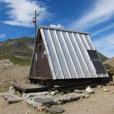
The normal route starts in Italy from Rifugio Città di Busto (2480 m), climbs the Ghiacciaio dei Camosci and crosses the Gran sella del Gries to the summit, mostly on glacier, so watch for crevasses; rated F. A southern variant leaves Rifugio Claudio e Bruno (2710 m) and is now considered the normal route. From Switzerland, the route goes from the Passo della Novena past Lago Gries up the Gries Glacier, and depends on crevasse conditions.

The summit sits on the main Alpine watershed, which changes direction at the peak: the crest arrives from the east, bends northwest just before the top, then turns southwest toward the Blinnen pass. A secondary ridge descends southeast from just below the summit.

The community of curious travelers

AroundUs brings together thousands of curated places, local tips, and hidden gems, enriched daily by 93,662 contributors worldwide.

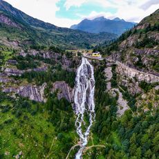
Start exploring
GPS coordinates
46.42591,8.30777
Latest update
October 25, 2026 08:28
Reviews
Share your experience

No review yet

Discussions
Start a discussion...

No discussion yet

« Blinnenhorn - Alpine summit in Lepontine Alps, Switzerland » is provided by Around Us (aroundus.com). Images and texts are derived from Wikimedia project under a Creative Commons license. You are allowed to copy, distribute, and modify copies of this page, under the conditions set by the license, as long as this note is clearly visible.

Discover hidden gems everywhere you go!

From secret cafés to breathtaking viewpoints, skip the crowded tourist spots and find places that match your style. Our app makes it easy with voice search, smart filtering, route optimization, and insider tips from travelers worldwide. Download now for the complete mobile experience.
Around Us App Screenshot
❝

A unique approach to discovering new places❞

— Le Figaro

❝

All the places worth exploring❞

— France Info

❝

A tailor-made excursion in just a few clicks❞

— 20 Minutes

Around Us
Travel Guide & Maps
Download

Send to your phone

QR Code
1

Open the camera app on your mobile.

2

Point at the QR code with your camera. A notification will appear.

3

Tap the notification to open the link.