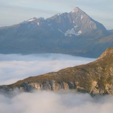
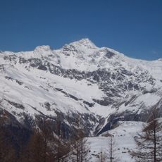
Surettahorn, Mountain summit in Oberhalbstein Range, Switzerland.
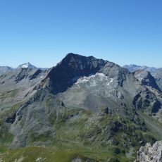
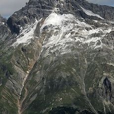
The Surettahorn is a double-peaked mountain on the Swiss-Italian border east of the Splügen Pass. Its western summit, Punta Nera, reaches 3,026 m; the eastern Punta Rossa is 3,021 m and looks distinctly yellow despite its name. A third point on the southeast ridge, Punta Adami, stands at 2,978 m. Glaciers lie on the north, east and south flanks, though only the southern one, Ghiacciaio di Suretta, is named on the national map.
The mountain stands near the Splügen Pass, which was a key trade route connecting northern and southern Europe for centuries. This historic passage shaped the development of the surrounding alpine region.
The name Surettahorn derives from the village of Sufers, with the Rhaeto-Romanic root Sur and the suffix -etta, meaning roughly 'Sufers alp'. The two summits carry Italian names: Punta Nera, the higher western peak, and Punta Rossa, the eastern one, which is nonetheless strikingly yellow. A third, less marked point on the southeast ridge is called Punta Adami (2,978 m).
Spring and summer offer the best conditions for climbing, when weather is more favorable and snow cover decreases. Access to the mountain starts from the Montespluga base, which offers several different routes.
The two summits differ in colour: the higher Punta Nera (3,026 m) means "black peak", while the 3,021 m Punta Rossa, "red peak", is noticeably yellow. A third, less marked point on the south-east ridge is counted as Punta Adami at 2,978 m. The crossing between the two main summits takes about a quarter of an hour and is exposed in places.
The community of curious travelers
AroundUs brings together thousands of curated places, local tips, and hidden gems, enriched daily by 92,716 contributors worldwide.