Chest opened
+${chestReward.xp} XP
Explorer
NOUVEAU ×${chestReward.collectible.quantity}
tapez pour fermer

See the monuments around you in AR Open chests in the app

Around Us is built for your phone — point your camera at the streets and discover the monuments and places around you in augmented reality. Around Us is built for your phone — chests unlock when you walk, explore and capture nearby places.

•

Enable Location

We need your location to show you interesting places around you

Discover nearby places

Find interesting locations and hidden gems around you

Precise directions

Get accurate directions and distances to places

Your location is never shared with other users. It's only used when you tap the location button.

Vorder Glärnisch

Log in to your account

Start exploring — it's free

Trusted by 93,877 travelers worldwide

Continue with Google
Continue with Apple
or

We will send you a code to connect

By continuing, you accept our Terms and Conditions and our Privacy Policy

Check your inbox

We've sent a pincode in your inbox. Please enter the code below.

Vorder Glärnisch

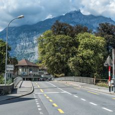
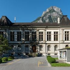
Vorder Glärnisch, Alpine summit in Glarus, Switzerland

Vorder Glärnisch is an Alpine summit in the Schwyzer Alps reaching 2,328 meters, part of the larger Glärnisch massif. The peak offers views across the surrounding valleys and regional landscape.

The mountain was shaped by tectonic forces during the formation of the Alps millions of years ago. These geological processes created the ridges and valleys of the region as it appears today.

The normal route starts in the Klöntal via Hinter Saggberg and Schlattalpli and is marked as a blue-and-white alpine route (T4). The ascent from Schwändi carries no marking but can be found with a map and description, helped by old waymarks, and is rated T5 for experienced mountaineers.

The climb demands Alpine experience and proper gear, particularly when ascending the northwest face. Clear weather and daylight hours are needed for a safe route to the top.

The Vorderglärnisch splits the Glarus main valley: the Klöntal with its lake runs west toward the Pragel Pass, the Linth valley southeast toward the Klausen Pass. These are the only two drivable exits from the canton besides the northern valley mouth. Its limestone dates from the Jurassic and Cretaceous.

The community of curious travelers

AroundUs brings together thousands of curated places, local tips, and hidden gems, enriched daily by 93,877 contributors worldwide.

Start exploring
GPS coordinates
47.02206,9.04119
Latest update
October 25, 2026 12:06
Reviews
Share your experience

No review yet

Discussions
Start a discussion...

No discussion yet

« Vorder Glärnisch - Alpine summit in Glarus, Switzerland » is provided by Around Us (aroundus.com). Images and texts are derived from Wikimedia project under a Creative Commons license. You are allowed to copy, distribute, and modify copies of this page, under the conditions set by the license, as long as this note is clearly visible.

Discover hidden gems everywhere you go!

From secret cafés to breathtaking viewpoints, skip the crowded tourist spots and find places that match your style. Our app makes it easy with voice search, smart filtering, route optimization, and insider tips from travelers worldwide. Download now for the complete mobile experience.
Around Us App Screenshot
❝

A unique approach to discovering new places❞

— Le Figaro

❝

All the places worth exploring❞

— France Info

❝

A tailor-made excursion in just a few clicks❞

— 20 Minutes

Around Us
Travel Guide & Maps
Download

Send to your phone

QR Code
1

Open the camera app on your mobile.

2

Point at the QR code with your camera. A notification will appear.

3

Tap the notification to open the link.