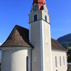
Rigi Hochflue, Mountain summit in Central Switzerland
Rigi Hochflue is a summit within the Rigi massif in central Switzerland with views across Lake Lucerne and Lake Lauerz. The ridge formations and rock faces create distinctive shapes that characterize this location.
The peak was documented in the early 19th century by Swiss mapmakers and included in national surveys. Since then it has remained a standard reference point in regional geographical records.
The name Rigi comes from a Swiss German word for the horizontal bands of rock and grass that ring the summit; it first appears around 1350 in a description of the Küssnacht estate, as "Rigenen", and was reduced to the singular "Rigi" in a 1439 document. Humanists later linked it to the Latin Regina montium, queen of the mountains.
Rigi Hochflue lies west of the Urmiberg ridge, above the Gersauerbecken of Lake Lucerne to the south and Lake Lauerz to the north, in the canton of Schwyz. The nearest public transport is the Brunnen–Urmiberg cable car to 1,135 m; from there the summit is reached on foot, so allow time for the climb and check conditions before setting out.
The Hochflue's south face drops toward the Gersauerbecken of Lake Lucerne while its north side overlooks Lake Lauerz, so two different lakes lie below the same summit. The German Wikipedia notes that the limestone pinnacles of the Hoflue and the Gersauer- or Vitznauerstock are the part of the Rigi massif that still counts as Alps, unlike the softer Nagelfluh conglomerate around them.
The community of curious travelers
AroundUs brings together thousands of curated places, local tips, and hidden gems, enriched daily by 94,623 contributors worldwide.