Schollbergstrasse, Mountain hiking trail in eastern Switzerland
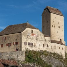
Schollbergstrasse is the old road built from 1490 and completed in 1492 between Sargans and Trübbach, crossing the Schollberg through the Howand. It is 2.5 metres wide, cut into steep, slippery terrain above the Rhine plain, and survives as a footpath where it was not buried, quarried away or replaced by the 1822 cantonal road.
The Old Schollbergstrasse was completed in 1492 as the first "national" road of the Old Swiss Confederacy, decided at the Tagsatzung in Lucerne in 1490 to link Sargans and Werdenberg with the newly acquired lands beyond the Schollberg. It replaced the Matug pack trail, over 200 m higher, and was 2.5 m wide. After the 1822 cantonal road was built, it lost its importance.
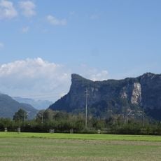
The road's name comes from the Schollberg, the obstacle it was built to cross. At Vild, near the key point of the route, a horse-changing post, a salt trading depot and a customs station for collecting tolls were set up; the Vild customs post is mentioned as early as 1490 in one of the first account books of the Sargans bailiff. Since 2014 the restored route is meant to form a section of the Via Rhenana long-distance trail from Lake Constance to Graubünden.
The trail is accessible from several public transport stops with parking available near the main access points. Sturdy footwear is recommended and you should check weather conditions before heading out.
The 2010–2012 restoration used cement-free special mortar and limestone from the region, and archaeologists dug test trenches beforehand to recover the road's original width and course. Where a large quarry had destroyed the route, a bypass tunnel was built in 2014.
The community of curious travelers
AroundUs brings together thousands of curated places, local tips, and hidden gems, enriched daily by 92,773 contributors worldwide.