Lommatzsch, Administrative municipality in Meissen District, Germany.
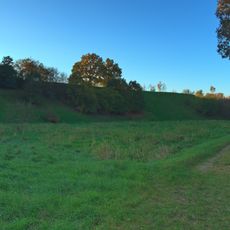
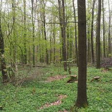
Lommatzsch is a municipality in Meissen District in Saxony with strong agricultural roots. The area sits on loess soil that makes it ideal for growing crops and has shaped how people use the land here.
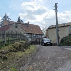
The area first appeared in records in 1286 and grew from West Slavic settlement that started around 800 CE. These early roots shaped the landscape and cultural heritage that survives today.
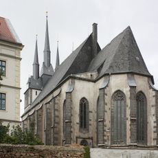
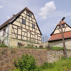
St. Wenceslaus Church shapes the town center with its Gothic style and shows how the community turned Protestant in the 1500s. Visitors can see how this shift left its mark on the local architecture and religious life.
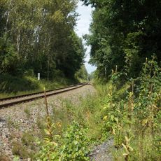
The town is easy to explore on foot with straightforward access to main spots like the market square and the church. There is plenty of space and quiet paths to experience the agricultural surroundings.
In 1330 local citizens received brewing rights from Margrave Frederick I in exchange for tax payments. This unusual deal shows how rulers granted economic privileges to raise money and strengthen local ties.
Location: Meissen District
Elevation above the sea: 168 m
Shares border with: Nossen, Ostrau, Käbschütztal
Website: https://lommatzsch.de
GPS coordinates: 51.20000,13.30000
Latest update: December 20, 2025 16:17
Railway line 6613
105 mGlomuci
2.5 km
Stadtkirche St. Wenzel
716 m
Bahnhof Lommatzsch
960 m
Menhir de Steudten
6.2 km
Depot von Wauden
3.9 km
Trockenhänge südöstlich Lommatzsch
3.3 km
Großholz
5.6 kmEckardsberg
6.5 kmKuh-Berg
4.2 kmEhemalige Schule (heute Kinderhort) Robert-Volkmann-Allee 19
792 mHuthübel
6.2 kmEich-Berg
5 kmKirche (einschließlich Ausstattung), Kirchhof mit Leichenhalle, Einfriedungsmauer, Torpfeiler und Treppenaufgang sowie Kriegerdenkmal für die Gefallenen des 1. Weltkrieges und einige Grabmale Striegnitzer Straße -
2.9 kmFriedhof mit Friedhofskapelle, Grufthaus, Verwaltungsgebäude in der Friedhofsmauer, mehrere Grabmale, Epitaphien und Grabanlagen, die gesamte Friedhofsmauer, Eingangstor und Pflasterung am Eingangsbereich des Friedhofs Döbelner Straße 33
696 mVilla Carl-Menzel-Straße 15
546 mKirche (mit Ausstattung), Kirchhof mit Einfriedung, Denkmal für die Toten des Zweiten Weltkrieges sowie Grabmal Dorfstraße -
5.2 kmVilla (mit rückwärtigem Anbau) und Stützmauer Nossener Straße 41
1.1 kmEhemaliges Molkerei-Gebäude Dorfstraße 2
5 kmWohnhaus in geschlossener Bebauung Nossener Straße 11
966 mMietvilla mit Einfriedung Nossener Straße 38
1.2 kmStraßenbrücke über die Bahnstrecke Riesa–Nossen Lommatzsch
798 m
Mertitz 10
3.4 kmEisenbahnstrecke Riesa–Nossen Schwochau
2.4 km
Kirche Staucha
6 kmWohnhaus in Ecklage Meißner Straße 1
805 m
Mettelwitz 3
3.7 kmWohnhaus in geschlossener Bebauung, mit Hintergebäude im Hof Frauenstraße 6
716 mVisited this place? Tap the stars to rate it and share your experience / photos with the community! Try now! You can cancel it anytime.
Discover hidden gems everywhere you go!
From secret cafés to breathtaking viewpoints, skip the crowded tourist spots and find places that match your style. Our app makes it easy with voice search, smart filtering, route optimization, and insider tips from travelers worldwide. Download now for the complete mobile experience.
A unique approach to discovering new places❞
— Le Figaro
All the places worth exploring❞
— France Info
A tailor-made excursion in just a few clicks❞
— 20 Minutes