
Guttau, part of Malschwitz, Germany
Location: Malschwitz
Elevation above the sea: 146 m
Website: http://www.gemeinde-guttau.de/
Part of: Sorbian settlement area
Website: http://gemeinde-guttau.de
GPS coordinates: 51.25889,14.56028
Latest update: March 26, 2025 10:23
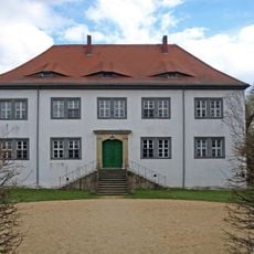
Schloss Spreewiese
2.3 km
Kirche Klix
2.5 km
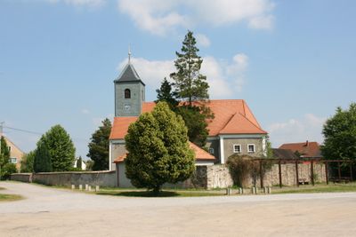
Kirche Guttau
67 m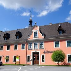
Rittergut Klix/Klukš
2.4 km
Evangelische Pfarrkirche und Kirchhof Klix (Sachgesamtheit) Hauptstraße 30
2.6 km
Inschrifttafel der ehemaligen Kirchschule Guttauer Hauptstraße 20 (ehemals Hauptstraße 20)
18 m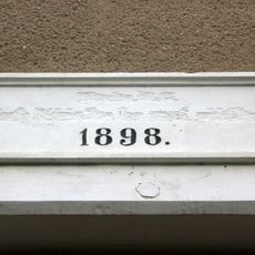
Schule mit Gedenktafel für Korla Awgust Kocor (1822–1904) Warthaer Dorfstraße 30 (ehemals Dorfstraße 30)
2.4 km
Gasthof mit Tanzsaal über Eck Hauptstraße 31
2.5 km
Denkmal für die Gefallenen des Ersten Weltkrieges in Guttau
58 m
Steinkreuz nördlich von Gleina
1.4 km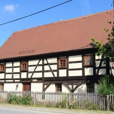
Hauptstraße 40
2.7 km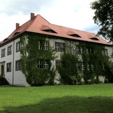
Rittergut und Gutspark Spreewiese (Sachgesamtheit) Schloßweg 1, 2, 4, 6
2.3 km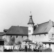
Herrenhaus und Gutspark (Einzeldenkmal zu ID-Nr. 09300541) Zum Rittergut 1
2.5 km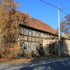
Wohnhaus eines Bauernhofes, ehemals mit Gaststätte Spreewieser Straße 3
2.5 km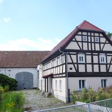
Wohnstallhaus und Stallscheune eines Gehöfts, davor Gedenkstein für Karl Traugott Schütze Hauptstraße 14
2.5 km
Steinkreuz östlich Guttau
968 m
Pfarrhaus Rosengasse 22
2.5 km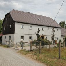
Wohnhaus Salgaer Straße 11
3.5 km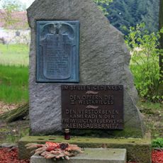
Denkmal für die Gefallenen des Ersten Weltkrieges mit Ehrenhain (Gartendenkmal) Am Ehrenhain (ehemals Am Park )
3 km
Wohnhaus eine Bauernhofes Am Anger 9
696 m
Rittergut
2.3 km
Wohnstallhaus eines ehemaligen Vierseithofes Zum Auenwald 23
2 km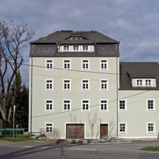
Klixer Mühle
2.5 km
Herrenhaus (Nr. 10, 12) mit zwei flankierenden Linden vor dem Eingangsbereich, Schornstein der ehemaligen Brennerei (Nr. 7), südliche Scheune (Nr. 9), südwestliche Einfriedungsmauer des ehemaligen Gartengrundstücks und Reste des Gartens sowie nord
109 m
Gasthof Guttau Guttauer Hauptstraße 11 (ehemals Hauptstraße 11)
69 m
Pfarrhaus Guttauer Hauptstraße 19 (ehemals Hauptstraße 19)
39 m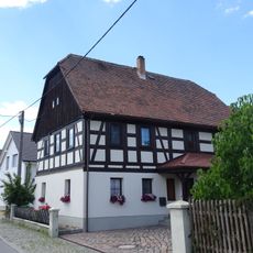
Wohnstallhaus Hauptstraße 32
2.6 km
Schornstein Am Anger (Ecke Gutsweg)
727 mReviews
Visited this place? Tap the stars to rate it and share your experience / photos with the community! Try now! You can cancel it anytime.
Discover hidden gems everywhere you go!
From secret cafés to breathtaking viewpoints, skip the crowded tourist spots and find places that match your style. Our app makes it easy with voice search, smart filtering, route optimization, and insider tips from travelers worldwide. Download now for the complete mobile experience.

A unique approach to discovering new places❞
— Le Figaro
All the places worth exploring❞
— France Info
A tailor-made excursion in just a few clicks❞
— 20 Minutes