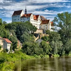
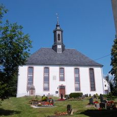
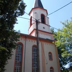
Colditz, Medieval town in Leipzig District, Germany
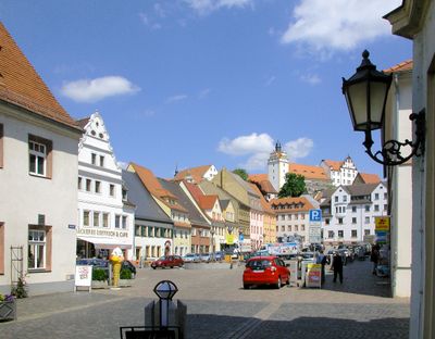
Colditz is a medieval town in Leipzig District situated along the Zwickau Mulde river. A castle rises above the town square and surrounding buildings, overlooking the marketplace below.
The settlement was founded in 1046 when Henry III ordered construction of a fortified community named Cholidistcha on the Mulde. The castle developed into a significant fortress during the centuries that followed.
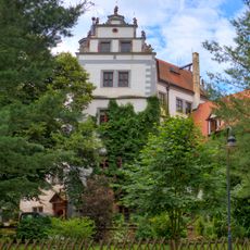
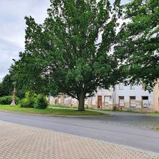
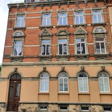
The town square is framed by townhouses with Renaissance details that reflect Saxon craftsman traditions. These buildings shape the character of the place and invite people to linger.
The castle offers guided visits, with opening hours available at local tourist information. The town center is easy to explore on foot, and the main pathways are straightforward to navigate.
During World War II, the castle housed a prisoner-of-war camp where Allied officers made numerous escape attempts from Oflag IV-C. These events brought international attention to the town.
Location: Landkreis Leipzig
Elevation above the sea: 156 m
Shares border with: Grimma, Leisnig, Hartha, Geringswalde, Zettlitz, Königsfeld, Bad Lausick
Website: https://colditz.de
GPS coordinates: 51.11667,12.81667
Latest update: December 20, 2025 13:39
Colditz Castle
1.7 km
Podelwitz Castle
4.2 km
Stadtkirche St. Aegidien
1.6 km
Kirche Altleisnig zu Polditz
9 km
Heimatturm
483 m
Kirstenmühle-Schanzenbachtal
5.9 km
Kirche Zschadraß
2.3 km
Kohlbachtal
3.5 km
Kursächsische Postmeilensäule
8.7 km
Lache Alteisnig
8.6 km
Kirche (mit Ausstattung), Kirchhof mit Einfriedung und Kriegerdenkmal auf dem Kirchhof Talstraße 33
4.4 kmFuchsgrund Schwarzbach Teil 1
2.7 km
Dental Museum
2.3 kmTiergarten Colditz
1.7 kmRats-Berg
1.8 kmMuldentalbahn (Sachgesamtheit); Eisenbahnbrücke
3.9 kmSachgesamtheit Schloss Colditz und Tiergarten mit folgenden Einzeldenkmalen: Schloss mit Nebengebäuden (Obj. 08973185), sog. Terrassenhaus (Obj. 08973184), zwei (ehemals vier) Torhäuser im Tiergarten (Obj. 08973461 und 08973186), Tiergartenmauer mi
2.1 km
Lime tree of Glasten
9.5 km
Kirche Zschirla
2.6 kmEhemalige Schule Zschirlaer Dorfstraße 21
2.6 kmSchule Schulstraße 12
1.5 kmMuldentalbahn (Sachgesamtheit)
6.7 kmMuldentalbahn (Sachgesamtheit)
2.6 km
Part of Railroad line Muldetalbahn (Glauchau - Großbothen) subsection Colditz
3.9 kmSchule Hauptstraße 34
1.1 km
Elm tree by the church, Zschirla
2.6 km
Kleiner Goldfischteich
1.4 km
Bahnhofstraße 17
2 kmVisited this place? Tap the stars to rate it and share your experience / photos with the community! Try now! You can cancel it anytime.
Discover hidden gems everywhere you go!
From secret cafés to breathtaking viewpoints, skip the crowded tourist spots and find places that match your style. Our app makes it easy with voice search, smart filtering, route optimization, and insider tips from travelers worldwide. Download now for the complete mobile experience.
A unique approach to discovering new places❞
— Le Figaro
All the places worth exploring❞
— France Info
A tailor-made excursion in just a few clicks❞
— 20 Minutes