Zeisigwald, Forest and recreation area in Hilbersdorf and Euba, Germany
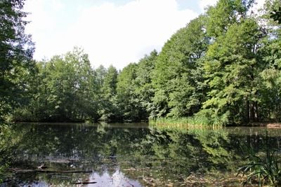
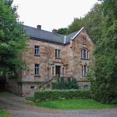
Zeisigwald is a large forest area in Hilbersdorf and Euba, spanning roughly 600 hectares and forming the biggest connected forest within Chemnitz municipality. The highest point sits at Beutenberg, which rises to about 421 meters.
The forest received its first recorded mention in 1331 as 'des Keisers Forste' when it belonged to the Benedictine monastery of Chemnitz. Ownership changed hands several times over the centuries, each shift sometimes reflected in different names the local people used.
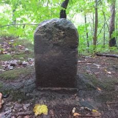
The name Zeisigwald comes from historical bird-catching practices that focused on siskins, small songbirds that lived here. This activity shaped how local people understood and used this forest for many generations.
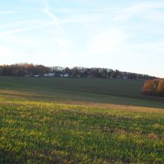
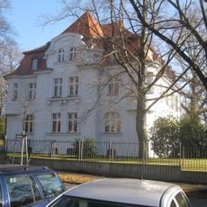
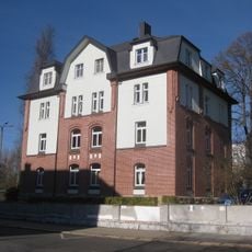
The forest contains numerous hiking paths and cycling routes connecting several districts including Gablenz, Sonnenberg, Yorckgebiet, and Hilbersdorf. Various recreational facilities throughout the area make it convenient to spend time walking, cycling, or simply relaxing among the trees.
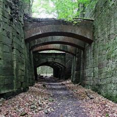
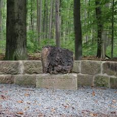
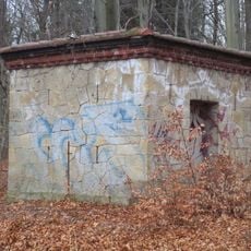
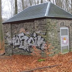
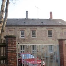
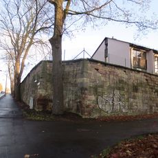
Porphyry tuff has been extracted from quarries here since the 15th century and used for many construction projects across Chemnitz and surrounding areas. This stone resource played an important role in how the city and region developed and built their structures.
Location: Hilbersdorf
Location: Euba
GPS coordinates: 50.84530,12.96940
Latest update: December 8, 2025 19:55
Beutenberg
924 m
Zeisigwaldschänke
420 m
Teufelsbrücken Chemnitz
1 km
Villa mit Vorgarten Dresdner Straße 147
1.2 km
Heinrich-Schütz-Straße 114 Chemnitz-Sonnenberg
1.2 km
Zeisigwaldstraße 80, Chemnitz-Yorckgebiet
783 m
Direktorenvilla der ehemaligen städtischen Nervenheilanstalt Dresdner Straße 180
1.2 km
Zeisigwaldstraße 76, Chemnitz-Yorckgebiet
859 m
Heinrich-Schütz-Straße 116 Chemnitz-Yorckgebiet
1.2 km
Ehrenmal Zeisigwald
274 m
Mietshaus in geschlossener Bebauung mit Vorgarten Heinrich-Schütz-Straße 118
1.2 km
Dresdner Straße 230, Chemnitz-Hilbersdorf
1.1 km
Wohnhaus in offener Bebauung Heinrich-Schütz-Straße 107
1.1 km
Grenzsteine Grenzweg
274 m
Memorial to Heinrich Cotta
562 m
Mietshaus in geschlossener Bebauung mit Vorgarten Heinrich-Schütz-Straße 120
1.2 km
Doppelmietshaus in geschlossener Bebauung mit Vorgarten Heinrich-Schütz-Straße 124; 126
1.1 km
Mietshaus in geschlossener Bebauung mit Vorgarten Heinrich-Schütz-Straße 128
1.1 km
Doppelmietshaus in geschlossener Bebauung mit Vorgarten Heinrich-Schütz-Straße 130; 132
1.1 km
Pulverhaus Steinweg
326 m
Mietshaus in geschlossener Bebauung mit Vorgarten Heinrich-Schütz-Straße 136
1.1 km
Mietshaus in Ecklage mit Vorgarten Heinrich-Schütz-Straße 138
1.1 km
Verwaltungsgebäude (mit vier Hausnummern) Zeisigwaldstraße 69; 71; 73; 75
1 km
Transformatorenhäuschen Steinweg
462 m
Ehemaliges Wirtschaftsgebäude des Bauernhofes Aurich Dresdner Straße 178
1.1 km
Mietshaus in geschlossener Bebauung mit Vorgarten Heinrich-Schütz-Straße 134
1.1 km
Dresdner Straße 232; 234 Chemnitz
1.2 km
Mietshaus in geschlossener Bebauung mit Vorgarten Heinrich-Schütz-Straße 112
1.2 kmVisited this place? Tap the stars to rate it and share your experience / photos with the community! Try now! You can cancel it anytime.
Discover hidden gems everywhere you go!
From secret cafés to breathtaking viewpoints, skip the crowded tourist spots and find places that match your style. Our app makes it easy with voice search, smart filtering, route optimization, and insider tips from travelers worldwide. Download now for the complete mobile experience.
A unique approach to discovering new places❞
— Le Figaro
All the places worth exploring❞
— France Info
A tailor-made excursion in just a few clicks❞
— 20 Minutes