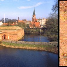
Ludwigsluster Kanal, Canal system in Ludwigslust-Parchim District, Germany
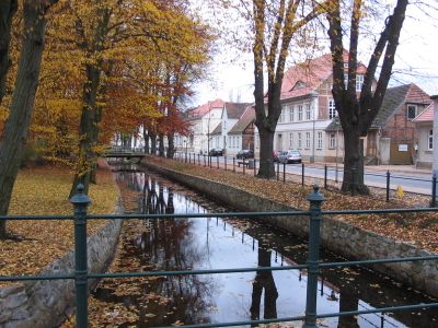
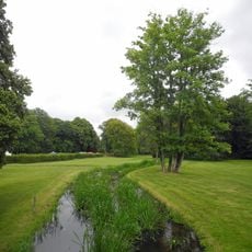
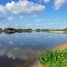
The Ludwigsluster Canal is a waterway extending roughly 28 kilometers through the landscape, flowing from Tuckhude to the Rognitz. The system connects various water bodies and features channels and structures along its course.
The waterway was constructed between 1756 and 1760 to supply water for the ducal palace gardens. This relatively swift building period resulted in a system that would serve the region for generations.
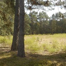
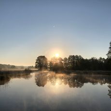
The waterway shapes how people experience the surrounding landscape, serving as a favored spot for walks and outdoor activities throughout the seasons. The tree-lined banks create a green passage that connects different parts of the region.
You can fish in two sections: from Ludwigslust to the Rognitz confluence and from Tuckhude Bridge to Federal Road B106. The paths along the waterway are easy to explore on foot and offer multiple access points.
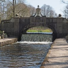
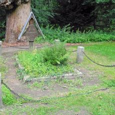
The cascade featuring sandstone figures was built in 1780 and displays three late Baroque works by sculptor Rudolf Kaplunger. The system also includes weirs and bypass channels specifically engineered to allow fish passage.
Location: Ludwigslust-Parchim District
Inception: 1756
Elevation above the sea: 32 m
GPS coordinates: 53.26400,11.28970
Latest update: December 9, 2025 12:26
Dömitz Fortress
13.9 km
Elbebrücke Dömitz
14 km
Stadtkirche Ludwigslust
14.7 km
Helenen-Paulownen-Mausoleum
14.5 km
Church of Saint Helena and Saint Andrew (Ludwiglust)
14.6 km
Johanneskirche
13.9 km
Windmühle Kummer
9.5 km
Jasnitz railway station
14.7 km
Church in Lübtheen
14.4 km
Church in Redefin
11.1 km
Church of Wehningen
13.1 km
Blaues Wasser
10.9 km
Fritz-Reuter-Lichtspiele
13.9 km
Dorfkirche Leussow
1.5 km
Karenz Observation Tower
5.6 km
Stone Bridge
14.5 km
Herz Jesu
13.8 km
Alte Elde zwischen Wanzlitz und Krohn
14 km
Grave of Aleksandr Alekseevič Musin-Puškin
14.5 km
Friedrich Franz III.
14.8 km
Maria Rosenkranz
14.1 km
Schloßpark Ludwigslust
14.1 km
Stolperstein dedicated to Gottfried Wolff
14.5 km
Stolperstein dedicated to Bernhard Aronsohn
14.4 km
Niedersächsische Mittelelbe
11.4 km
Grave of Heinrich XXXVIII. Reuss zu Köstritz
14.5 km
Stolperstein dedicated to Meta Wolff
14.5 km
Stolperstein dedicated to Franz Wolff
14.5 kmVisited this place? Tap the stars to rate it and share your experience / photos with the community! Try now! You can cancel it anytime.
Discover hidden gems everywhere you go!
From secret cafés to breathtaking viewpoints, skip the crowded tourist spots and find places that match your style. Our app makes it easy with voice search, smart filtering, route optimization, and insider tips from travelers worldwide. Download now for the complete mobile experience.
A unique approach to discovering new places❞
— Le Figaro
All the places worth exploring❞
— France Info
A tailor-made excursion in just a few clicks❞
— 20 Minutes