Karlsbad, Non-urban municipality in Baden-Württemberg, Germany.
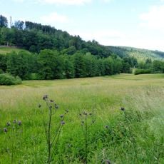
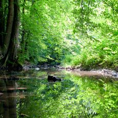
Karlsbad is a rural municipality in the Karlsruhe district of Baden-Württemberg, formed by five villages. The area features rolling terrain with diverse architectural styles reflecting the character of each village center.
Five villages—Langensteinbach, Auerbach, Mutschelbach, Spielberg, and Ittersbach—combined into a single municipality in 1971 as part of administrative reforms. This merger reshaped local governance and community boundaries across the region.
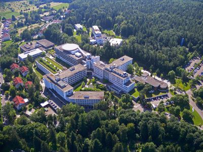
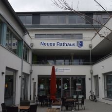
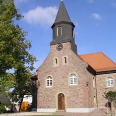
Each of the five villages maintains its own local customs and character that visitors can still notice today. Langensteinbach serves as the administrative center and gives the municipality its main focal point.
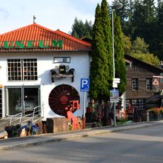
The area connects to surrounding regions through the Alb Valley Railway and regional bus services, making it accessible for visitors. Rolling terrain offers good opportunities for walking around each village and exploring local centers.
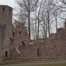
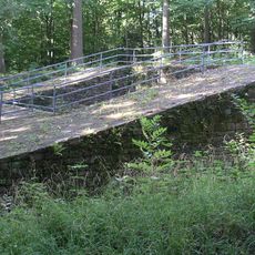
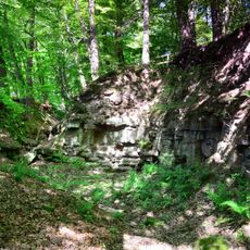
The ruins of the Saint Barbara chapel dating from the 1300s and the Römerturm tower remain hidden in the local landscape as reminders of earlier settlement. These structures show that the area was inhabited long before the modern municipal borders were established.
Location: Landkreis Karlsruhe
Elevation above the sea: 264 m
Shares border with: Karlsruhe, Marxzell, Ettlingen, Waldbronn
Phone: +4972029304400
Website: https://karlsbad.de
GPS coordinates: 48.90384,8.50883
Latest update: December 13, 2025 14:22
Fahrzeugmuseum Marxzell
6.5 km
Barbarakapelle
927 m
Burg Langensteinbach
880 m
Albtal und Seitentäler
4.4 km
Badisches Schulmuseum Karlsruhe
5.2 km
Karlsbad community library
1.2 km
Mistwiesen
5.1 km
Bocksbach und obere Pfinz
2.8 km
Bocksbachtal (Landkreis Karlsruhe)
3.3 km
Waldbronner Albgau
3.7 km
Karlsbader Bachlandschaften
847 m
Protestant Church
2.8 km
Linde bei der Anne-Frank-Schule
4.6 km
Linde Waldstraße
4.8 km
Tornadowald
2.6 km
Auerbachwiese
1.2 km
Birnbaum an der L 562
1.8 km
Linde beim Waldspielplatz
3.3 km
Bocksbachtal (Landkreis Enzkreis)
5.6 km
Radiomuseum
3.3 km
Eiche Taubenbrunnenwiesen
2.2 km
Eiche Mistwiesen
4.6 km
2 Solitäreichen Ecke Berg- und Talstraße
4.1 km
Roßkastanie bei der Kirche
4.7 km
Birnbaum an der Läng
6.1 km
Linde in der Remchinger Straße
2.2 km
Eiche am Talweg
1.9 km
Alteichenhorst, Eichenbusch
1.8 kmVisited this place? Tap the stars to rate it and share your experience / photos with the community! Try now! You can cancel it anytime.
Discover hidden gems everywhere you go!
From secret cafés to breathtaking viewpoints, skip the crowded tourist spots and find places that match your style. Our app makes it easy with voice search, smart filtering, route optimization, and insider tips from travelers worldwide. Download now for the complete mobile experience.
A unique approach to discovering new places❞
— Le Figaro
All the places worth exploring❞
— France Info
A tailor-made excursion in just a few clicks❞
— 20 Minutes