Fossa Carolina, Archaeological canal in Weißenburg in Bayern, Germany
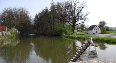
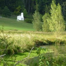
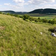
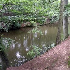
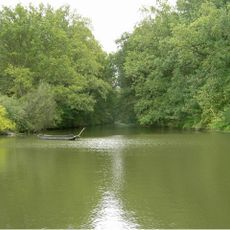
The Fossa Carolina is a medieval canal near Weißenburg that was meant to connect the Rezat river to the Altmühl. The ditch system cuts through the landscape between two major river basins and shows the efforts made to improve transportation routes at that time.
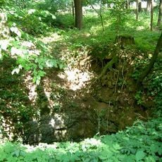
The canal was begun in 793 under Charlemagne's direction and required large workforces and technical knowledge for this ambitious project. Although the work remained incomplete, the visible earthworks today show the technical ambition of that era.
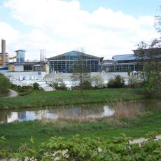
The site includes interpretive materials explaining medieval engineering methods and showcases artifacts that detail the development of transportation systems in early Europe.
You can visit about 500 meters of the remaining canal and observe earthen banks that reach several meters in height. The best place for your visit is the municipality of Treuchtlingen, where the traces are most clearly visible.
Archaeological investigations have uncovered an unusual stepped profile at the bottom of the ditch, pointing to thoughtful water management. This reveals that engineers of that time were already experimenting with innovative solutions to control water effectively.
Location: Weißenburg in Bayern
Elevation above the sea: 410 m
Part of: Fossa Carolina mit Ortskern Graben
Address: Fossa Carolina, Karlsgraben
GPS coordinates: 48.98587,10.92415
Latest update: December 7, 2025 19:25
DRG 01 220 → DB 001 2250-3
3.2 km
Altmühltherme
3.3 km
City Palace
3.4 km
Untere Papiermühle
2.7 km
Volkskundemuseum Treuchtlingen
3.4 km
Scheunenkirche Dettenheim
1.6 km
Schambachried
2.3 km
Schloss Dettenheim
1.6 km
Osterdorfer Löcher
3.3 km
Obere Papiermühle
3.2 km
Marienkirche
3.1 km
St. Nikolaus
1.7 km
St. Kunigunde
532 m
St. Johannes
3.4 km
St. Ulrich zum Heiligen Kreuz
2.4 km
St. Willibald
2.9 km
Bergkuppe des Bubenheimer Berges E von Bubenheim
2 km
Statue of Gottfried Heinrich Graf zu Pappenheim
3.4 km
Bauernhaus
1.5 km
Bauernhaus eines Dreiseithofes
475 m
Befestigungsmauer Fossa Carolina; Karlsgrabenstraße in Treuchtlingen
297 m
Karlsgraben
51 m
Heinrich-Aurnhammer-Straße 16
3.4 km
Wohnstallhaus
1.4 km
Bahnbetriebswerk Treuchtlingen, Verwaltungsgebäude
2.2 km
Scheune
1.7 km
Scheune
1.7 km
Brauereigasthof "Zur Sonne" (Weißenburg in Bayern)
1.6 kmVisited this place? Tap the stars to rate it and share your experience / photos with the community! Try now! You can cancel it anytime.
Discover hidden gems everywhere you go!
From secret cafés to breathtaking viewpoints, skip the crowded tourist spots and find places that match your style. Our app makes it easy with voice search, smart filtering, route optimization, and insider tips from travelers worldwide. Download now for the complete mobile experience.
A unique approach to discovering new places❞
— Le Figaro
All the places worth exploring❞
— France Info
A tailor-made excursion in just a few clicks❞
— 20 Minutes