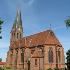
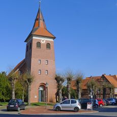
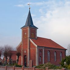
Bleckede, Urban municipality in Lüneburg district, Germany
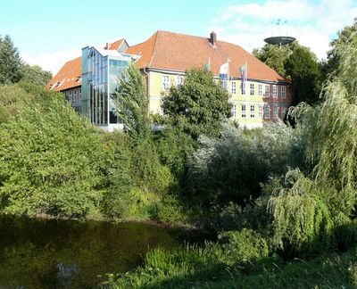
Bleckede is an urban municipality situated on the left bank of the Elbe River, roughly 20 kilometers east of Lüneburg in Lower Saxony. The town spreads along the waterfront in a linear pattern that follows the river's course through northern Germany.
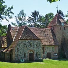
The settlement became important in 1209 when William of Winchester founded it as a Welf stronghold and established ship tolls along the river. Control of river traffic made it a strategic location in the region during medieval times.
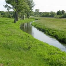
The river setting shapes local life, with the Elbe at the heart of how the community connects to its surroundings. Walking through town, you sense that river trade and navigation have long defined what this place is about.
The town has good access to the river with public paths that run along the Elbe, making it easy to explore the waterfront. Orientation is straightforward since the river forms the main feature and natural boundary of the settlement.
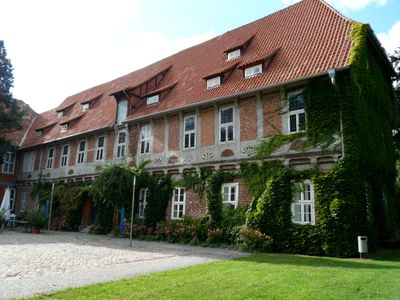
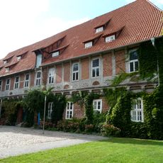
The ElbSchloss here has foundations dating back to 1270 and shows the historical importance of river navigation to this area. The structure reveals that the location once served as a checkpoint for both travel and commerce along the waterway.
Location: Lüneburg
Elevation above the sea: 6 m
Shares border with: Scharnebeck, Tosterglope, Dahlem, Lower Saxony
Website: https://bleckede.de
GPS coordinates: 53.30000,10.73333
Latest update: December 20, 2025 12:54
Elbschloss Bleckede
556 mMegalithanlagen im Schieringer Forst
8.9 km
Church in Blücher
8.8 km
Peter and Paul Church, Thomasburg
9.2 km
St. Maria Königin vom hl. Rosenkranz
1.4 km
Elbhang Vierwald
8.8 km
St. Jacobikirche
729 m
St.-Vitus-Kirche
7.2 km
Saint Willibrord Church
8.4 km
Church of the Redeemer, Alt Garge
5.4 km
Ganggrab von Barskamp
7.4 kmGroßsteingräber bei Radenbeck
10.9 km
Chapel of Our Lady in Stiepelse
4.7 km
Church in Radegast bei Bleckede
5 kmBassen-Berg
10.1 km
Schaaleniederung zwischen Zahrensdorf und Blücher
8.5 kmBR ELB Pflegezone "Elbtallandschaft und Sudeniederung bei Boizenburg"
6.1 kmElbtallandschaft und Sudeniederung bei Boizenburg
5.7 km
Stolperstein dedicated to Ottilie Rosen
808 m
Stolperstein dedicated to Joseph Rosen
808 m
Stolperstein dedicated to Otfried Rosen
808 mBiosphärenreservat Flusslandschaft Elbe Mecklenburg-Vorpommern PZ 3
5.6 kmAusstellung
5 kmBiosphaerium Elbtalaue
566 mObstbaum-Lehrpfad "Apfel des Jahres"
3.2 kmAussicht auf Ellringen
9.2 kmAussichtsturm
4.6 kmÜbersichtspunkt Viehler Höhe
7.5 kmVisited this place? Tap the stars to rate it and share your experience / photos with the community! Try now! You can cancel it anytime.
Discover hidden gems everywhere you go!
From secret cafés to breathtaking viewpoints, skip the crowded tourist spots and find places that match your style. Our app makes it easy with voice search, smart filtering, route optimization, and insider tips from travelers worldwide. Download now for the complete mobile experience.
A unique approach to discovering new places❞
— Le Figaro
All the places worth exploring❞
— France Info
A tailor-made excursion in just a few clicks❞
— 20 Minutes