Ostrach, municipality in Germany
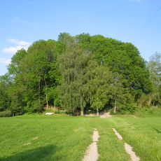
Ostrach is a small municipality in the Sigmaringen district of Baden-Württemberg, situated in a valley surrounded by hills and forests. The town spans several districts including Burgweiler and Laubbach with around 6,600 residents living in quiet neighborhoods among fields and old farmhouses.
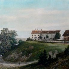
The first recorded mention of Ostrach dates to 851, when the Salem monastery later took control of the area for centuries. In the 19th century the town came under Prussian rule, and in 1978 it received its official coat of arms featuring symbols from the medieval period.
The name Ostrach comes from the small stream that flows through the town and has shaped life here for centuries. Today, residents gather regularly for festivals and markets where local crafts and traditions remain alive and the community comes together.
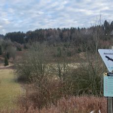
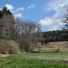
Visitors should take time for walks through the surrounding forests and fields, especially in the nature reserves Pfrunger-Burgweiler Ried and Schwarzes Moos. Local restaurants serve regional dishes and small guesthouses offer simple, friendly accommodations for those wanting to enjoy the rural quiet.
Ostrach was once an important administrative center with its own courts until Prussian rule in 1850, a historical role often overlooked today. The railway passed through for many years until the last freight train departed in 2002, fundamentally changing the character of the place.
The community of curious travelers
AroundUs brings together thousands of curated places, local tips, and hidden gems, enriched daily by 60,000 contributors worldwide.