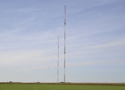
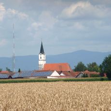
Aholming transmitter, Radio transmission tower in Aholming, Germany.
The Aholming transmitter was a radio facility consisting of two tall steel lattice towers near the village of Aholming. The installation worked by sending radio signals across Lower Bavaria and beyond through a combination of broadcasting equipment positioned at the site.
This facility began broadcasting in 1989, taking over the role from an older radio site. Programming continued until 2014, when longwave radio technology was phased out.
The transmitter played a central role in German radio communications by broadcasting information and programs across Lower Bavaria and surrounding regions.
The site is no longer publicly accessible today as it remains private property. You can view the area from the surrounding roads, though nothing remains of the original towers.
Both towers were completely demolished in 2018, leaving an empty field that now marks where this radio facility once stood. This location represented one of Germany's final longwave broadcast centers.
Location: Aholming
GPS coordinates: 48.73000,12.93100
Latest update: December 11, 2025 11:08
Schloss Moos
3 km
Kastell Moos-Burgstall
1.7 km
Wallfahrtskirche zum Kreuzberg
5.2 km
Schloss Ottmaring
1.8 km
Isaraltwasser bei Neutiefenweg
5.4 km
Abschnittsbefestigung Burgstall
1.7 km
Saint John the Baptist Church
1.8 km
St. Laurentius
3.7 km
Katholische Pfarrkirche St. Peter und Paul
4.3 km
St. Stephanus (Aholming)
1.5 km
Katholische Pfarr- und Expositurkirche St. Martin
5.4 km
Katholische Pfarrkirche St. Simon und Judas Thaddäus
2.2 km
St. Kilian (Tabertshausen)
3.6 km
Katholische Filialkirche St. Jakobus der Ältere
2.5 km
Wegkapelle
2.3 km
Feldkapelle
5.1 km
Katholische Pfarrkirche Mariä Geburt
4.9 km
Feldkapelle
1.5 km
Kriegergedächtniskapelle
5.2 km
Kapelle St. Johannes der Täufer
2.7 km
Isarmündung
5.4 km
Altlaufsenke zwischen äußerem Mühlgraben und Kühmoos
4.7 km
Wohnstallhaus
1.2 km
Bildstock
3.5 km
Kruzifix
5.3 km
Wohnstallhaus eines Dreiseithofes
1.7 km
Donauauen zwischen Straubing und Vilshofen
5.5 km
Untere Isar oberhalb Mündung
5.4 kmVisited this place? Tap the stars to rate it and share your experience / photos with the community! Try now! You can cancel it anytime.
Discover hidden gems everywhere you go!
From secret cafés to breathtaking viewpoints, skip the crowded tourist spots and find places that match your style. Our app makes it easy with voice search, smart filtering, route optimization, and insider tips from travelers worldwide. Download now for the complete mobile experience.
A unique approach to discovering new places❞
— Le Figaro
All the places worth exploring❞
— France Info
A tailor-made excursion in just a few clicks❞
— 20 Minutes