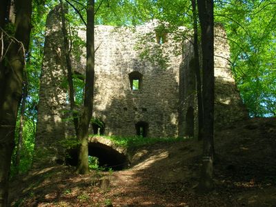
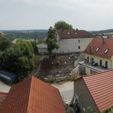
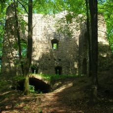
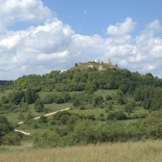
Burgruine Roßstein, Medieval castle ruin in Hohenburg, Germany.
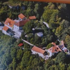
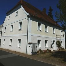
Burgruine Roßstein is a medieval castle set on a rocky outcrop surrounded by steep cliffs on three sides and protected by a deep moat carved into the stone. The site contains a residential tower with vaulted cellars, a shield wall on the western side, and scattered wall remnants that show the fortress's former defensive layout.
The fortress first appeared in records in 1331 under Konrad Erlheimer's control and served as an important stronghold for generations. A major fire caused significant damage in 1411, but the ruins were rebuilt and remained occupied until they were finally abandoned around 1563.
The castle's name comes from Old High German 'hros', meaning horses, which later became Middle High German 'ros' for knights' warhorses. This naming choice reflects how the fortress was tied to cavalry and medieval warfare.
The ruins are freely accessible and can be reached by parking at Spießhof and following marked trails through the forest. Wear suitable footwear as the paths are uneven and access involves crossing rocky ground.
The residential tower features large windows in its upper floors, which hints at comfort and living space unusual for castles of that era. This suggests the site served domestic purposes beyond just military defense.
Location: Hohenburg
Address: Vordere Zell
GPS coordinates: 49.30925,11.87359
Latest update: December 9, 2025 12:24
Schloss Winbuch
2 km
Wallfahrtskirche Mariä Heimsuchung
4.7 km
Zum Gegeißelten Heiland
5.4 km
Burg Rieden
5 km
Mariä Himmelfahrt
5.2 km
Katholische Wallfahrtskirche St. Dionys und Nothelfer (Ensdorf)
4.8 km
St. Peter
3.7 km
Torhaus
4.9 km
Schlosskapelle St. Bartholomäus
2.1 km
St. Laurentius
5.4 km
Katholische Kapelle St. Johannes Baptist, sogenannte Jagdkapelle
4.9 km
Kapellenbildstock Zum gegeißelten Heiland
257 m
Kapelle St. Hubertus
4.7 km
Marienkapelle Friebertsheim
2 km
Kreisverordnung über den Schutz von Landschaftsteilen im Markt Hohenburg und in der Gemeinde Adertshausen des Landkreis Amberg
3.2 km
Dreifaltigkeitskapelle Egelsheim
978 m
Köferinger Tal, Köferinger Heide, Hirschwald und Vilstal südlich von Amberg
5.3 km
Lauterachtal und Vilstal (Westseite)
5.2 km
Wegkapelle Kreuther Straße
4.9 km
Lauterachtal
5.2 km
St. Konrad
2.9 km
Burgruine Rieden
5.1 km
Ehemaliges Forsthaus
4.9 km
Halbwalmbau
5.2 km
Truppenübungsplatz Hohenfels
5.4 km
Wappenrelief
5.4 km
Wohnstallhaus
5.1 km
Brunnmühle 2
3.5 kmVisited this place? Tap the stars to rate it and share your experience / photos with the community! Try now! You can cancel it anytime.
Discover hidden gems everywhere you go!
From secret cafés to breathtaking viewpoints, skip the crowded tourist spots and find places that match your style. Our app makes it easy with voice search, smart filtering, route optimization, and insider tips from travelers worldwide. Download now for the complete mobile experience.
A unique approach to discovering new places❞
— Le Figaro
All the places worth exploring❞
— France Info
A tailor-made excursion in just a few clicks❞
— 20 Minutes