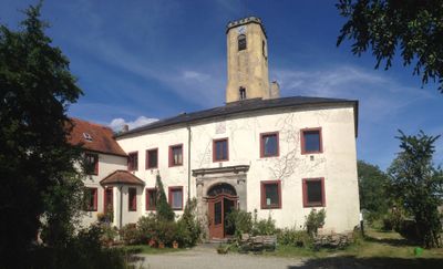
Burg Wahrberg, Medieval castle in Aurach, Germany
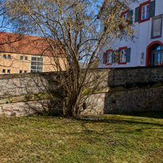
Burg Wahrberg is a medieval fortress in Middle Franconia perched at about 490 meters elevation with encircling walls and moats forming its defense system. The estate displays 13th-century structures and now serves as an event venue and lodging facility.
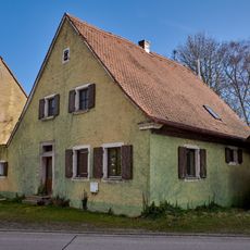
The castle first appeared in written records in 1258 when Ulrich von Wahrberg surrendered the estate to his feudal superior, Count Ludwig von Oettingen. This transfer marked a turning point in the settlement's governance and development.
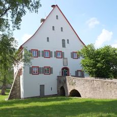
The castle operates as a seminar and conference venue, blending its medieval past with contemporary educational activities. Visitors find a place where historic walls host modern gatherings and professional meetings.
The estate offers various rooms ranging from single accommodations to shared dormitories alongside seminar spaces of different sizes for events and gatherings. Visitors planning extended stays should inquire about all available facilities in advance.
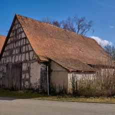
Since 1979 the estate has operated an organic farm emphasizing grain production and horse breeding on its surrounding lands. This combination of historic site and working agricultural operation gives the place a distinctive character.
Location: Aurach
Inception: 800
Address: Gut Wahrberg 1
GPS coordinates: 49.23868,10.40838
Latest update: December 9, 2025 12:24
Burg Aurach
3.9 km
St. Vitus
4.4 km
St. Peter und Paul
838 m
St. Martin
6.2 km
St. Jakobus der Ältere
3.4 km
Mariä Sieben Schmerzen
3.2 km
Johann-Nepomuk-Kapelle
1 km
Mater Dolorosa
2.9 km
Prozessionskapelle
3.2 km
Prozessionskapelle
3.4 km
Prozessionskapelle
3.3 km
Prozessionskapelle
3.3 km
Votivkapelle
619 m
Kapelle D-5-71-114-12
761 m
Steinkreuz in Weinberg
3.6 km
Nebengebäude Weinberger Straße 12 in Aurach (Landkreis Ansbach)
749 m
Verbindungsbrücke Im Mooshof 4 in Aurach (Landkreis Ansbach)
745 m
Scheune Im Mooshof 5 in Aurach (Landkreis Ansbach)
706 m
Graben Im Mooshof 4 in Aurach (Landkreis Ansbach)
733 m
Ehemaliger Zwiehof, Wohnstallhaus
720 m
Friedhofsmauer Kirchplatz 1 in Aurach (Landkreis Ansbach)
840 m
Bildsäule
651 m
Wohnhaus
691 m
Neunstetterstraße 15, 17
6.2 km
Ehemalige Vogtei, jetzt Rathaus
733 m
Neunstetterstraße 11, 13
6.2 km
Wohnhaus D-5-71-114-6
826 m
Wohnhaus D-5-71-114-9
737 mVisited this place? Tap the stars to rate it and share your experience / photos with the community! Try now! You can cancel it anytime.
Discover hidden gems everywhere you go!
From secret cafés to breathtaking viewpoints, skip the crowded tourist spots and find places that match your style. Our app makes it easy with voice search, smart filtering, route optimization, and insider tips from travelers worldwide. Download now for the complete mobile experience.
A unique approach to discovering new places❞
— Le Figaro
All the places worth exploring❞
— France Info
A tailor-made excursion in just a few clicks❞
— 20 Minutes