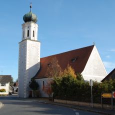
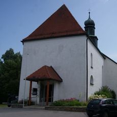
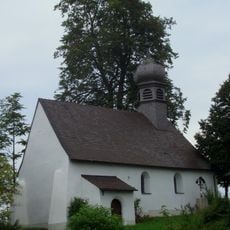
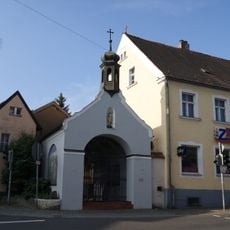
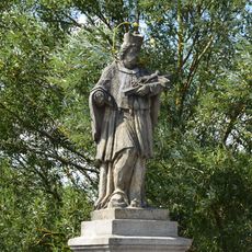
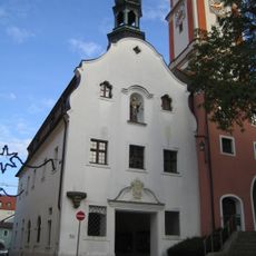
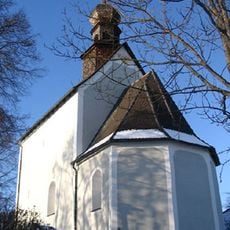
Heilbruennl, Baroque filial church in Roding, Germany
Heilbruennl is a baroque parish church in Roding with white walls and Rococo elements, its core dating from the early 18th century. At the center of the nave sits a marble basin that collects water from a natural spring.
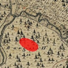
This place started as a martyrs column and developed through a chapel built in 1668, which underwent major expansion between 1684 and 1691. The baroque design followed this building phase and has shaped its appearance since then.
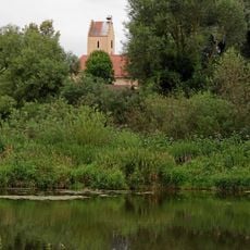
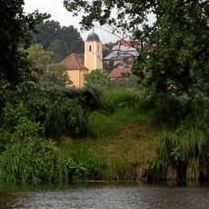
Visitors come to collect water from the natural spring, showing how deeply the belief in this place's healing power runs through the region. This faith has endured across generations and continues to shape how local people relate to the site.
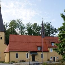
The church maintains regular visiting hours and sits in an easily accessible part of town where visitors can also find local restaurants nearby. Plan time to explore the details inside and collect water from the spring basin if you wish.
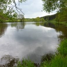
The spring beneath the marble basin was revered long before the current building was constructed, drawing people seeking healing. The water still collects naturally in this basin today without requiring any artificial channeling.
Location: Roding
Architectural style: baroque architecture
Address: Heilbrünnl 1
GPS coordinates: 49.19213,12.49375
Latest update: December 9, 2025 12:28
Kloster Strahlfeld
5.6 km
Burg Wetterfeld
4.9 km
St. Pankratius
1.8 km
Burg Regenpeilstein
1.3 km
Josephi- und Anna-Kapelle Roding
1.8 km
St. Vitus
5.8 km
Burgstall Kirchenrohrbach
5.8 km
St. Ulrich (Wetterfeld)
5 km
St. Martin
6.8 km
Regentalhänge zwischen Kirchenrohrbach und Zenzing
5.6 km
St. Bartholomäus
6.3 km
St. Maria Magdalena (Kirchenrohrbach)
6.5 km
Freibad Platschare Roding
2.8 km
Christuskirche
1.8 km
Kalvarienbergkapelle
5.8 km
Dream Garage Roding
2.1 km
Sebastianikapelle
1.7 km
Pfarrhof
5.7 km
Figur des hl. Johannes Nepomuk
5.6 km
Steinkreuz
4.7 km
Rathaus
1.8 km
Ehemalige katholische Filialkirche St. Peter und Paul, seit 1962 Leichenhaus
6 km
Brücke über den Altbach (Untertraubenbach)
6.8 km
Ehemaliges Bezirksamt, vormals Meierhof
1.6 km
Roding Oberer Markt 2
1.7 km
NSG 'Regentalhänge zwischen Kirchenrohrbach und Zenzing'
5.3 km
'''Ensemble Marktplatz und Brückenkopf'''
3.6 km
Chamb, Regentalaue und Regen zwischen Roding und Donaumündung
3.8 kmVisited this place? Tap the stars to rate it and share your experience / photos with the community! Try now! You can cancel it anytime.
Discover hidden gems everywhere you go!
From secret cafés to breathtaking viewpoints, skip the crowded tourist spots and find places that match your style. Our app makes it easy with voice search, smart filtering, route optimization, and insider tips from travelers worldwide. Download now for the complete mobile experience.
A unique approach to discovering new places❞
— Le Figaro
All the places worth exploring❞
— France Info
A tailor-made excursion in just a few clicks❞
— 20 Minutes