Michelfeld Abbey, Benedictine monastery in Auerbach in der Oberpfalz, Germany.
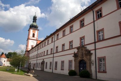
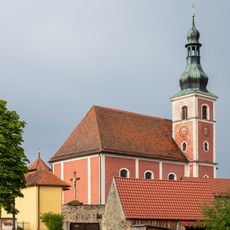
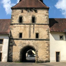
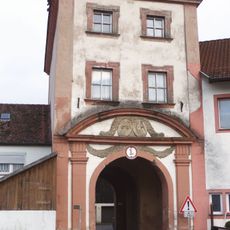
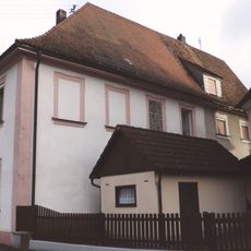
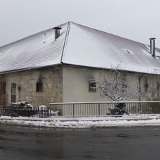
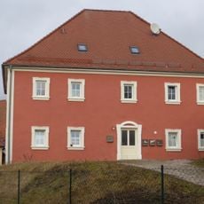
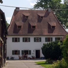
Michelfeld Abbey is a former Benedictine monastery in Upper Palatinate with a church redesigned in the 1700s. The compound consists of several connected buildings arranged around a central area that together form the monastic layout.
The monastery was founded in 1119 by Bishop Otto I of Bamberg and served as an important religious center for centuries. Its role as a Benedictine community ended with Bavarian secularization in 1803.
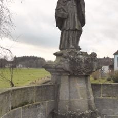
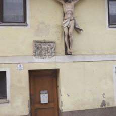
The name reflects devotion to Saint Michael that ran deep in the region. You can still see this religious focus expressed in how the complex is designed and used today.
The site now functions as a care facility run by the Franciscan Sisters of Dillingen. Keep in mind that it remains an active residential complex, so access to certain areas may be limited.
Architects Wolfgang and Johann Dientzenhofer worked on reshaping the church and brought their skills to the building's design. Their involvement shows how regional projects drew expertise from recognized masters of the time.
Location: Auerbach in der Oberpfalz
Inception: May 6, 1119
Founders: Otto of Bamberg
Architects: Wolfgang Dientzenhofer, Johann Dientzenhofer
Address: Klosterhof 6
GPS coordinates: 49.70410,11.58704
Latest update: December 8, 2025 19:50
Burgstall Gernotenstein
402 m
Kapelle Hl. Dreifaltigkeit
858 m
Marienkapelle
985 m
Höhle beim Felslindl
1.6 km
Friedhof
437 m
Bettelküche bei Staubershammer
521 m
Guckerlochfelsen E von Michelfeld
459 m
Hanslhöhle
2 km
Fachwerkbau mit Walmdach
141 m
Schmelcherfels SW von Steinamwasser
2.3 km
Höhle Felslindl ENE von Saaß (A54)
1.8 km
Wohnhaus
254 m
Felsen am Speckbach ENE von Saaß
1.8 km
Brückenfigur des heiligen Johann von Nepomuk
152 m
Bauernhaus
977 m
Brauerei-, Stallungs- und Pförtnergebäude
71 m
Guckerloch
440 m
Kruzifix und Sandsteinrelief
179 m
Torturm Michelfeld
141 m
Bildstock
387 m
Ehemaliges Klosterrichterhaus
238 m
Ehemalige Klosterökonomie, sogenanntes Ökonomiehaus des ehemaligen Ökonomiehofs
179 m
Sandsteinbrüstung einer Brücke
223 m
Bildsäule
246 m
Wohnhaus
266 m
Ehemaliger Hammerhof
876 m
Bildstock Saaß
946 m
Wegkapelle bei Steinamwasser
2.5 kmVisited this place? Tap the stars to rate it and share your experience / photos with the community! Try now! You can cancel it anytime.
Discover hidden gems everywhere you go!
From secret cafés to breathtaking viewpoints, skip the crowded tourist spots and find places that match your style. Our app makes it easy with voice search, smart filtering, route optimization, and insider tips from travelers worldwide. Download now for the complete mobile experience.
A unique approach to discovering new places❞
— Le Figaro
All the places worth exploring❞
— France Info
A tailor-made excursion in just a few clicks❞
— 20 Minutes