Gefütterter Graben bei Ungelstetten
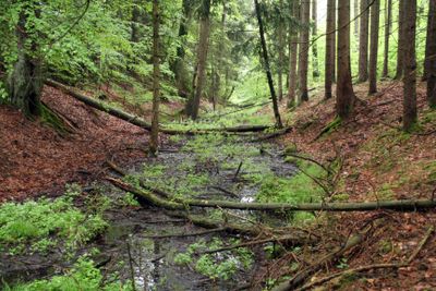
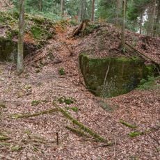
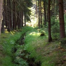
Gefütterter Graben bei Ungelstetten, Archaeological canal structure in Winkelhaid, Germany
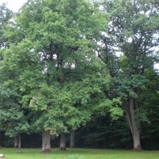
The Gefütterter Graben near Ungelstetten is a medieval canal with earthen walls and a channel depression stretching about one and a half kilometers near the Röthenbach area. The structure was built with clay lining to prevent water loss through the channel walls.
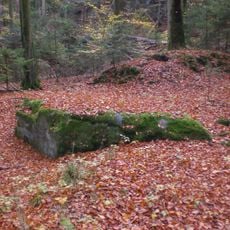
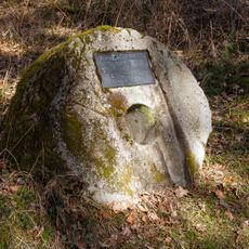
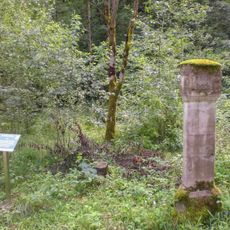
The project was built between 1423 and 1425 under architect Hans Velber from Ulm, who designed it to supply water to Nuremberg. The facility was part of a larger medieval infrastructure supporting the city's craft industries.
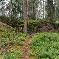
The canal demonstrates medieval water control techniques that craftspeople from Nuremberg relied on for their daily work. The way water was directed shows how essential clean water was for trades like leather working and dyeing.
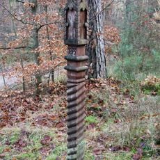
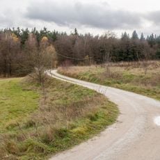
The site is accessible year-round via the Rotpunkt hiking trail starting from the road connecting Ungelstetten and Brunn. Wear sturdy footwear and follow the marked trails to explore the full extent of the canal and its structures.
The name comes from its clay lining, an innovative waterproofing solution still visible today. This early sealing technique shows how carefully medieval engineers designed water systems.
Location: Winkelhaid
Location: Nuremberg
Location: Fischbach
GPS coordinates: 49.42480,11.26980
Latest update: December 9, 2025 20:25
Ursprungtal bei Leinburg
2.2 km
Burg Brunn
2.1 km
Rote Marter bei Winkelhaid
2.4 km
Zimmermannskreuz bei Ungelstetten
2.2 km
Roesmühle bei Leinburg
1.9 km
Brunn - Netzstall
374 m
Birnthon
1.4 km
Nürnberger Reichswald
1.9 km
Scheune Birnthon 1 in Nürnberg (D-5-64-000-2237#1)
1.5 km
Ehem. Wohnstallhaus in Winkelhaid
2.5 km
Eichenhain bei Brunn
1.3 km
Wohnhaus Birnthon 7
1.5 km
Ehemaliges Gasthaus in Birnthon
1.5 km
Ehemaliger Herrensitz Birnthon
1.5 km
Wohnstallhaus in Winkelhaid
2.5 km
Wohnstallhaus in Winkelhaid
2.5 km
Cultural heritage D-5-6533-0195 in Nürnberg
1.5 km
Wohnstallhaus in Winkelhaid
2.5 km
Wasserwerk, zweigeschossiger Gebäudekomplex eines Pumpwerks mit Wärterhaus in Leinburg
2.1 km
Ehemaliger Steinbruch östlich von Fischbach b. Nürnberg
2.4 km
Rodungsinseln im Reichswald
943 m
Cultural heritage D-5-6533-0111 Brunn (gemeindefreies Gebiet)
2.1 km
Bighorn Ranch
1.4 km
Ursprung in Leinburg
2.2 km
Forstreviergrenzstein Fischbach, Feucht und Ungelstetten
2.2 km
Wohnstallhaus in Winkelhaid
2.4 km
Flurkreuz Birnthon
1.5 km
Sandsteinbruch nördlich von Moosbach
2.1 kmVisited this place? Tap the stars to rate it and share your experience / photos with the community! Try now! You can cancel it anytime.
Discover hidden gems everywhere you go!
From secret cafés to breathtaking viewpoints, skip the crowded tourist spots and find places that match your style. Our app makes it easy with voice search, smart filtering, route optimization, and insider tips from travelers worldwide. Download now for the complete mobile experience.
A unique approach to discovering new places❞
— Le Figaro
All the places worth exploring❞
— France Info
A tailor-made excursion in just a few clicks❞
— 20 Minutes