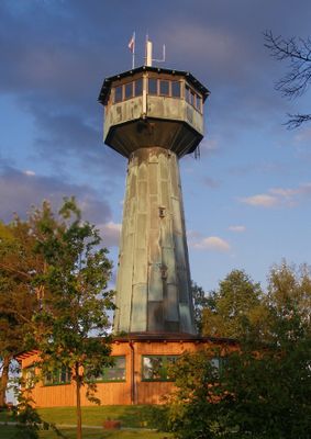
Grenzlandturm, Wooden observation tower in Bad Neualbenreuth, Germany.
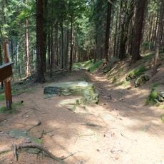
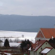
The Grenzlandturm is a wooden observation tower in Bad Neualbenreuth that stands approximately 20 meters tall. From its viewing platform, visitors look out over the Oberpfalz landscape and can see across the surrounding countryside on clear days.
The tower was inaugurated on June 4, 1961, following strong community commitment to the project. It came to symbolize connection with the Egerland region during a time of political division.
The name reflects the border zone between Germany and Czechoslovakia that once divided this area until 1989. Visitors can sense this shared regional history while climbing the structure and taking in the views across the landscape.
The tower is easily accessible to visitors and sits near several marked hiking trails in the area. Wearing comfortable shoes is helpful since you need to climb stairs, and visiting on clear days gives you the best views.
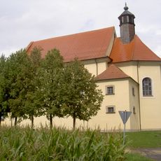
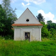
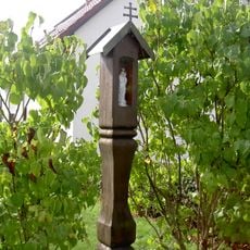
Next to the tower stands the Maria Frieden Chapel, dedicated in 1963 as a memorial to displaced persons and those who died from the region. This small chapel is a quiet spot that reflects the difficult history of 20th-century border conflicts.
Location: Bad Neualbenreuth
Height: 20 m
Made from material: wood
GPS coordinates: 49.98140,12.46190
Latest update: December 14, 2025 17:43
Schloss Hardeck
3.2 km
Kleine Kappl
2.8 km
Nigerlbuche
3.1 km
Königsstein
2.7 km
Sankt Laurentius
1.5 km
Chapel in Mýtina
2.6 km
Felsen am Lerchenbühl NE von Neualbenreuth
698 m
Neualbenreuth Turmstraße 5 und 7
1.4 km
Neualbenreuth Turmstraße 46 und 48
396 m
Kriegerdenkmal für die Gefallenen des Ersten Weltkriegs
1.5 km
Försterhaus, sogenanntes Egerer Forsthaus
1.8 km
Ehemaliges Egerer Amtshaus, 1830–1910 Schule, seit 1911 Rathaus
1.4 km
Katholisches Pfarrhaus, ehemals auch Schule
2.9 km
Wohnstallhaus
1.5 km
Mýtina 3
2.7 km
Wohnstallhaus eines Vierseithofes
911 m
Wohnstallhaus eines Vierseithofes
564 m
Stadel eines Vierseithofes
988 m
Hölzerner Säulenbildstock
1.3 km
Ausnahmshaus eines Hakenhofes
944 m
Ehemaliger Wohnteil eines Bauernhauses, seit 1886 Gasthaus
1 km
Wohnstallhaus eines Vierseithofes
843 m
Ehemaliges Gasthaus
1.5 km
Ehemaliges Schulhaus
1.6 km
Gradlhof
1.4 km
Wohnhaus eines Vierseithofes
1.4 km
Fachwerkobergeschoss des ehemaligen gutsherrschaftlichen Wirtshauses
2.8 km
Hausfigur des heiligen Florian
1.4 kmVisited this place? Tap the stars to rate it and share your experience / photos with the community! Try now! You can cancel it anytime.
Discover hidden gems everywhere you go!
From secret cafés to breathtaking viewpoints, skip the crowded tourist spots and find places that match your style. Our app makes it easy with voice search, smart filtering, route optimization, and insider tips from travelers worldwide. Download now for the complete mobile experience.
A unique approach to discovering new places❞
— Le Figaro
All the places worth exploring❞
— France Info
A tailor-made excursion in just a few clicks❞
— 20 Minutes