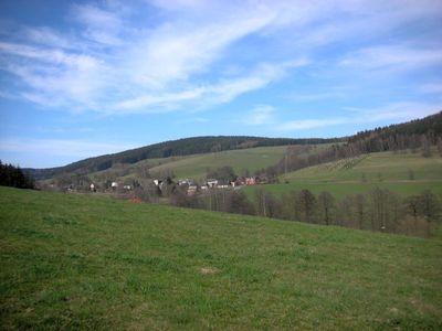
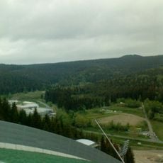
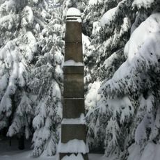
Hoher Brand, Mountain summit in Vogtlandkreis, Germany.
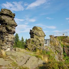
Hoher Brand is a mountain in Vogtlandkreis with an elevation of about 803 meters (2,635 feet), making it a notable landmark in the landscape. Its slopes support different plant communities and expose geological features that reflect the diverse character of this central German highland region.
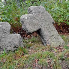
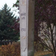
The mountain played a role in surveying and mapping the region, marked by a stone left by Royal Saxon surveyors during the 19th century. This marker shows how important the location was for geographical documentation of the area at that time.
The mountain attracts winter sports enthusiasts who gather regularly on its slopes and cross-country skiing trails. This tradition of meeting and recreation remains an important part of community life in the region.
Visitors can use several hiking paths with varying difficulty levels that suit different fitness levels and preferences. Access points have parking areas and information boards that help with navigation and explain the local geology and environment.
A stream flowing from the mountain has a reddish-brown color caused by iron ore deposits in the rock layers around the peak. This geological feature creates a striking visual element that visitors may notice along their trails.
Location: Vogtlandkreis
Elevation above the sea: 802.8 m
GPS coordinates: 50.34052,12.39029
Latest update: December 14, 2025 18:08
Musikinstrumenten-Museum Markneukirchen
5.6 km
Zum Friedefürsten church
5.8 km
Vysoký kámen
4.6 km
Schwarzberg
5.1 km
Church of Saint Giles
4.8 km
Marienkirche
5.9 km
Markneukirchen town hall
5.5 km
Penitence crosses in Kostelní
4.8 km
Markneukirchen Gymnasium
5.1 km
Ehemaliges Amtsgericht und Gefängnisgebäude Johann-Sebastian-Bach-Straße 13
5.6 km
Hraniční kámen
3.1 km
Villa mit Gartenpavillon, Einfriedung und Villengarten Adorfer Straße 20
5.9 km
Church St. Nicolai Markneukirchen
5.5 km
Chapel of Fourteen Holy Helpers
4.1 km
Harmonikamuseum Zwota
3.3 km
Haltepunkt Gunzen
4.2 km
Musik- und Wintersportmuseum
5.8 km
Kgl.-sächs. Postmeilenstein Markneukirchen
3.6 km
Kirche Erlbach
3.3 km
Kino Erlbacher Straße 4
5.1 km
Markneukirchen old town hall
5.3 km
Gemeindeamt Klingenthaler Straße 1
3.2 km
Postgebäude Adorfer Straße 1
5.7 km
Zwei Kriegerdenkmale Oberer Markt
5.4 km
Musikinstrumentenmuseum Bienengarten 2
5.5 km
Rathaus Markneukirchner Straße 32
2.8 km
Station 147 Hohenbrand
351 m
Polish-Saxon Post Milestones in Markneukirchen
5.7 kmVisited this place? Tap the stars to rate it and share your experience / photos with the community! Try now! You can cancel it anytime.
Discover hidden gems everywhere you go!
From secret cafés to breathtaking viewpoints, skip the crowded tourist spots and find places that match your style. Our app makes it easy with voice search, smart filtering, route optimization, and insider tips from travelers worldwide. Download now for the complete mobile experience.
A unique approach to discovering new places❞
— Le Figaro
All the places worth exploring❞
— France Info
A tailor-made excursion in just a few clicks❞
— 20 Minutes