Kaiserburg, Medieval castle ruin in Oberhausen, Germany.
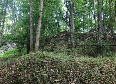
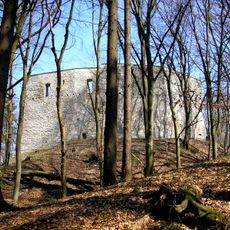
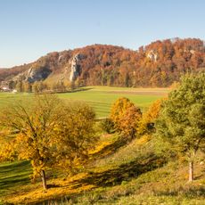
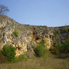
Kaiserburg is a castle ruin on Ulrichsberg hill in Oberhausen, Bavaria, situated at about 454 meters elevation. The limestone walls that remain show how a medieval fortress was laid out and what materials builders used for its construction.
The fortress was built between the 10th and 11th centuries and served first as imperial property. It later became a border stronghold for the counts of Graisbach, changing its role in regional power struggles.
The castle's teardrop-shaped design reflects medieval defense strategies that visitors can trace in the remaining walls. Walking around the site helps you understand how such fortifications were planned and built during that era.
Multiple walking paths lead you up to the ruins and through the site. The location is freely accessible and requires no entrance fee, making it easy to explore at your own pace.
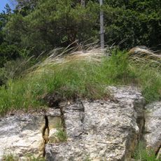
The walls are built from siliceous limestone, a local stone that was readily available in the surrounding hills. This choice of material reveals how medieval builders often used what the landscape nearby could provide.
Location: Oberhausen
GPS coordinates: 48.73040,11.10450
Latest update: December 9, 2025 20:24
Alte Burg
2.8 km
Schloss Sinning
4.5 km
Finkenstein
1.8 km
Kreut
3.2 km
Mariä Himmelfahrt
4.1 km
Sankt Johannes der Täufer
5.1 km
St. Michael
2.9 km
Kapelle
2 km
Katholische Filialkirche St. Vitus
4.6 km
Kirche
4.4 km
Wallfahrtskapelle St. Antonius und St. Anna
2.3 km
Gruftkapelle
2.3 km
Kapelle St. Maria
4.5 km
Schutz des Donautales westlich von Neuburg im Gebiet der Stadt Neuburg sowie der Märkte Burgheim und Rennertshofen und der Gemeinde Oberhausen, Landkreis Neuburg-Schrobenhausen
1.8 km
Schutz des Wellheimer Donautrockentales im Markt Rennertshofen, Landkreis Neuburg-Schrobenhausen
5.1 km
Amalienstraße A 28
5.2 km
Sehensander Weg 4
5.2 km
Katholische Pfarrhaus
5.1 km
Ehemaliger Steinbruch N von Laisacker
4.8 km
Ensemble Marktstraße
5 km
Ehemalige Kaserne, sogenannte Lassigny-Kaserne, mit Mannschafts- und Wirtschaftsgebäuden, 1886–1911, Hauptbauphase 1889/90. Sogenannte Alte Kaserne , jetzt Landratsamt
5.2 km
Oberer Brandl B 13
5.2 km
Ehemaliges Benefiziatenhaus
5.1 km
Markttor
5.2 km
Amtshaus
5.1 km
Friedhof
2.6 km
Platz der Deutschen Einheit 1
5.2 km
Oberer Brandl B 3
5.2 kmVisited this place? Tap the stars to rate it and share your experience / photos with the community! Try now! You can cancel it anytime.
Discover hidden gems everywhere you go!
From secret cafés to breathtaking viewpoints, skip the crowded tourist spots and find places that match your style. Our app makes it easy with voice search, smart filtering, route optimization, and insider tips from travelers worldwide. Download now for the complete mobile experience.
A unique approach to discovering new places❞
— Le Figaro
All the places worth exploring❞
— France Info
A tailor-made excursion in just a few clicks❞
— 20 Minutes