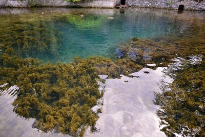
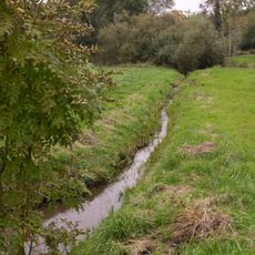
Lippequelle, Karst spring in Bad Lippspringe, Germany.
The Lippequelle is a karst spring in Bad Lippspringe where water flows constantly from underground limestone and enters the Lippe River. The water emerges visibly and powerfully from the ground, creating a natural feature that shapes the landscape around it.
This spring has been known since ancient times for its strong water flow and was important for settlements in the region. Over the centuries it remained a central location for trade and movement along the developing Lippe River.
The spring has long served as a vital water source that shaped the identity of Bad Lippspringe and the surrounding region. Locals view it as the heart of their landscape, and the water source remains central to how people understand their connection to this place.
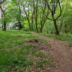
The spring is accessible year-round and the area has walking paths to explore its surroundings. Visitors will find the location easy to reach on foot or by public transport from Bad Lippspringe town center.
The water from this spring is known for its remarkable clarity because it has filtered through deep limestone layers underground. Visitors can directly observe how this natural filtration creates the pure appearance of the flowing water.
The community of curious travelers
AroundUs brings together thousands of curated places, local tips, and hidden gems, enriched daily by 60,000 contributors worldwide.