Enable Location

We need your location to show you interesting places around you

Discover nearby places

Find interesting locations and hidden gems around you

Precise directions

Get accurate directions and distances to places

Your location is never shared with other users. It's only used when you tap the location button.

Revierwasserlaufanstalt Freiberg

Log in to your account

Start exploring — it's free

Trusted by 62,268 travelers worldwide

Continue with Google
Continue with Apple
or

We will send you a code to connect

By continuing, you accept our Terms and Conditions and our Privacy Policy

Check your inbox

We've sent a pincode in your inbox. Please enter the code below.

Revierwasserlaufanstalt Freiberg

Revierwasserlaufanstalt Freiberg, Water management system in Freiberg, Germany.

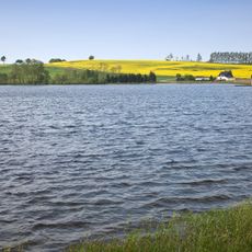
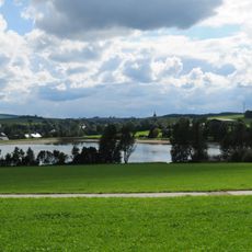
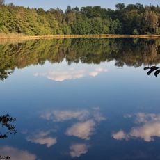
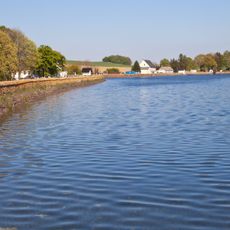
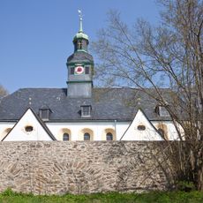
The Revierwasserlaufanstalt is a water management system in Freiberg that connects a network of lakes across the Ore Mountains region with aqueducts and channels. The network continues to supply drinking and industrial water to several cities through a series of artificial reservoirs in its upper section.

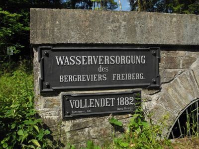
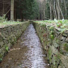
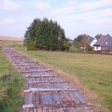
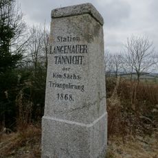
The system was designed starting in 1558 under Martin Planer to direct water from higher mountain areas to Freiberg's mining operations. This infrastructure became crucial to the mining industry and shaped the region's development for centuries afterward.

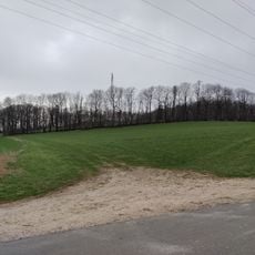
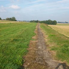
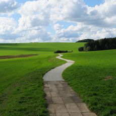
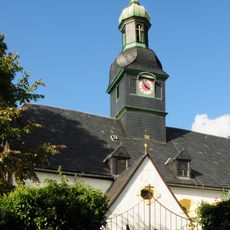
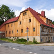
The system shows how people in this region have managed water for centuries to support their mining work. Visitors can see how the old channels and lakes shape the landscape and remain part of everyday life in the area.

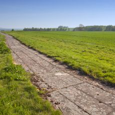
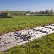
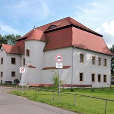
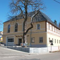
The system spreads across a large area and is best explored through individual lakes or canal sections scattered throughout the landscape. Visitors should check which parts are accessible, as not all sections are open to the public.

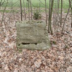
The system still operates according to the same basic principles as in the 16th century, with many original components continuing to function. This continuity makes it a rare example of infrastructure that has remained operational without major redesign.

The community of curious travelers

AroundUs brings together thousands of curated places, local tips, and hidden gems, enriched daily by 60,000 contributors worldwide.

Start exploring
Location
Inception
1558
Address
Großhartmannsdorf
GPS coordinates
50.81281,13.34213
Latest update
December 9, 2025 12:20
Around this place
Oberer Großhartmannsdorfer Teich
Germany

Oberer Großhartmannsdorfer Teich

3.4 km
Dorfkirche Helbigsdorf
Germany

Dorfkirche Helbigsdorf

1.7 km
Kohlbach-Kunstgraben
Germany

Kohlbach-Kunstgraben

4.1 km
Mittlerer Großhartmannsdorfer Teich
Germany

Mittlerer Großhartmannsdorfer Teich

1.7 km
Müdisdorfer Kunstgraben und Rösche
Germany

Müdisdorfer Kunstgraben und Rösche

122 m
Freiberger Bergwerksteiche
Germany

Freiberger Bergwerksteiche

853 m
Zethauer Kunstgraben
Germany

Zethauer Kunstgraben

783 m
Rittergut Großhartmannsdorf
Germany

Rittergut Großhartmannsdorf

2.3 km
Bernhardshöhe
Germany

Bernhardshöhe

3.3 km
Fire station Helbigsdorf
Germany

Fire station Helbigsdorf

1.7 km
Kohlbach Kunstgraben
Germany

Kohlbach Kunstgraben

1.7 km
Kirche Weigmannsdorf
Germany

Kirche Weigmannsdorf

4 km
Bethaus und Schule sowie Einfriedungsmauer des alten Dorffriedhofes Alte Poststraße 9
Germany

Bethaus und Schule sowie Einfriedungsmauer des alten Dorffriedhofes Alte Poststraße 9

3.9 km
Ehemalige Schule, langjährig Rathaus Neue Hauptstraße 120
Germany

Ehemalige Schule, langjährig Rathaus Neue Hauptstraße 120

4.1 km
Kirche mit Ausstattung, Kirchhof, Einfriedung mit Torbogen, ein Grabmal und Almosenstein sowie Denkmal für die Gefallenen des Deutsch-Französischen Krieges Hauptstraße 127
Germany

Kirche mit Ausstattung, Kirchhof, Einfriedung mit Torbogen, ein Grabmal und Almosenstein sowie Denkmal für die Gefallenen des Deutsch-Französischen Krieges Hauptstraße 127

2.5 km
Müdisdorfer Kunstgraben; Revierwasserlaufanstalt (Sachgesamtheit) Müdisdorf
Germany

Müdisdorfer Kunstgraben; Revierwasserlaufanstalt (Sachgesamtheit) Müdisdorf

428 m
Einzeldenkmale der Sachgesamtheit Revierwasserlaufanstalt: Kohlbach Kunstgraben mit einem Schütz, mit allen zugehörigen Gewölbebrücken und Röschen sowie zwei Röschenmundlöcher (siehe Sachgesamtheitsliste - Obj. 08991218)
Germany

Einzeldenkmale der Sachgesamtheit Revierwasserlaufanstalt: Kohlbach Kunstgraben mit einem Schütz, mit allen zugehörigen Gewölbebrücken und Röschen sowie zwei Röschenmundlöcher (siehe Sachgesamtheitsliste - Obj. 08991218)

2.5 km
Zethauer Kunstgraben; Zethauer Straßenrösche; Kirchenrösche; Revierwasserlaufanstalt (Sachgesamtheit) Zethau
Germany

Zethauer Kunstgraben; Zethauer Straßenrösche; Kirchenrösche; Revierwasserlaufanstalt (Sachgesamtheit) Zethau

3.1 km
Einzeldenkmal in o. g. Sachgesamtheit: ehemalige Bergschmiede, heute Wohnhaus (siehe auch Sachgesamtheitsdokument »Brander Revier« - obj. 09208604) Vereinigt Feld 1
Germany

Einzeldenkmal in o. g. Sachgesamtheit: ehemalige Bergschmiede, heute Wohnhaus (siehe auch Sachgesamtheitsdokument »Brander Revier« - obj. 09208604) Vereinigt Feld 1

3.9 km
Vermutlich ehemaliges Spritzenhaus Neue Hauptstraße 134
Germany

Vermutlich ehemaliges Spritzenhaus Neue Hauptstraße 134

4 km
Einzeldenkmale der Sachgesamtheit Kirche und Kirchhof Helbigsdorf: Kirche, Mauer (mit Steinkreuz), drei Grabmale (barock), Steinkreuz (1569), Grufthaus (1755) und Gedenkstein für die Gefallenen des Ersten und Zweiten Weltkrieges Hauptstraße 58a
Germany

Einzeldenkmale der Sachgesamtheit Kirche und Kirchhof Helbigsdorf: Kirche, Mauer (mit Steinkreuz), drei Grabmale (barock), Steinkreuz (1569), Grufthaus (1755) und Gedenkstein für die Gefallenen des Ersten und Zweiten Weltkrieges Hauptstraße 58a

1.6 km
Böhms-Mühle Mulda/Sa.
Germany

Böhms-Mühle Mulda/Sa.

4 km
Sommerlinde bei Zethau
Germany

Sommerlinde bei Zethau

3.8 km
Großhartmannsdorfer Großteich
Germany

Großhartmannsdorfer Großteich

650 m
Station 89 Langenauer Tännicht
Germany

Station 89 Langenauer Tännicht

2.8 km
Sachgesamtheit Kirche und Kirchhof Helbigsdorf mit den Einzeldenkmalen Kirche, Mauer (mit Steinkreuz), drei Grabmale (barock), Steinkreuz (1569), Friedhofskapelle (1755) mit Gruft und Gedenkstein für die Gefallenen des Ersten und Zweiten Weltkrieges
Germany

Sachgesamtheit Kirche und Kirchhof Helbigsdorf mit den Einzeldenkmalen Kirche, Mauer (mit Steinkreuz), drei Grabmale (barock), Steinkreuz (1569), Friedhofskapelle (1755) mit Gruft und Gedenkstein für die Gefallenen des Ersten und Zweiten Weltkrieges

1.6 km
Gedenkstein Freiwald -
Germany

Gedenkstein Freiwald -

3.4 km
Obersilberschnur obere 13. bis 20. Maß; Brander Revier (Sachgesamtheit) Brand-Erbisdorf
Germany

Obersilberschnur obere 13. bis 20. Maß; Brander Revier (Sachgesamtheit) Brand-Erbisdorf

3.8 km
Show the full map
« Revierwasserlaufanstalt Freiberg - Water management system in Freiberg, Germany » is provided by Around Us (aroundus.com). Images and texts are derived from Wikimedia project under a Creative Commons license. You are allowed to copy, distribute, and modify copies of this page, under the conditions set by the license, as long as this note is clearly visible.

Discover hidden gems everywhere you go!

From secret cafés to breathtaking viewpoints, skip the crowded tourist spots and find places that match your style. Our app makes it easy with voice search, smart filtering, route optimization, and insider tips from travelers worldwide. Download now for the complete mobile experience.

Around Us App Screenshot

A unique approach to discovering new places

Le Figaro

All the places worth exploring

France Info

A tailor-made excursion in just a few clicks

20 Minutes

Around Us
Travel Guide & Maps
Download

Send to your phone

QR Code
1

Open the camera app on your mobile.

2

Point at the QR code with your camera. A notification will appear.

3

Tap the notification to open the link.