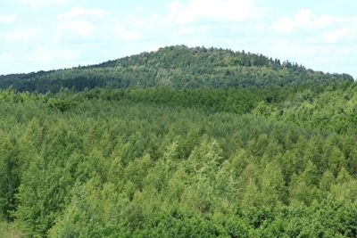
Schwarzer Berg, Mountain summit in Saxony, Germany.
Schwarzer Berg is a mountain summit in Saxony that rises to approximately 394 meters in elevation. The peak is accessible via several hiking trails and provides views of the surrounding landscape.
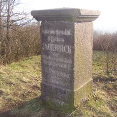
The mountain served as a natural boundary marker in Saxony since medieval times. Its dark appearance influenced the name that has persisted through the centuries.
The summit serves as a gathering place for local hikers who come to experience the surrounding landscape. People from nearby communities regularly visit to connect with the natural environment and enjoy the views across the region.
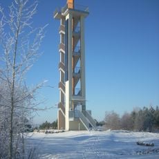
The summit is accessible via marked hiking trails with parking available at the base and rest areas positioned along the routes. Visitors should wear sturdy footwear and bring weather-appropriate clothing for changing conditions.
On clear days, the summit offers a 360-degree view across the Eastern Ore Mountains extending to distant neighboring peaks. The vantage point reveals the rolling landscape that characterizes this part of the region.
GPS coordinates: 51.09411,14.89784
Latest update: December 14, 2025 20:02
Aussichtsturm Neuberzdorfer Höhe
1.7 km
Erlöserkirche
3.6 km
Kirche St. Georg (Schönau-Berzdorf)
3.7 km
Dorfkirche Tauchritz
4.4 km
St. Ursulakirche
2 km
Rittergut Kunnerwitz
4 km
Grenzstein 15 KS KP
4.2 km
Wassermühle Tauchritz
4.2 km
Sächsisch-Preußischer Grenzstein: Pilar Nr. 17 (rechtselbisch)
3.9 km
Station 3 Jauernick
33 m
Kleine Seite 73
3.8 km
Sächsisch-Preußischer Grenzstein: Pilarpaar Nr. 23 (rechtselbisch)
3.7 km
Kriegerdenkmal für die Gefallenen des Ersten Weltkrieges, umgeben von kleiner Grünanlage Seestraße
3.4 km
Sächsisch-Preußischer Grenzstein: Pilarpaar Nr. 21 (rechtselbisch)
1.8 km
Wohnhaus und Einfriedung Weinhübler Straße 19
3.5 km
Leichenhaus, 14 Grabmale, zwei Grabanlagen, Gräberanlage für Gefallene des Zweiten Weltkrieges und Einfriedungsmauer (Einzeldenkmal zu ID-Nr. 09304262) Weinhübler Straße 18a (bei)
3.7 km
Herrenhaus, Gutscheune und drei Wirtschaftsgebäude, davon das südliche Gebäude mit Wohnhausanbau, Hofpflaster, das Denkmal der Liebe, eine Brücke und eine Steinbank im Gutspark sowie zwei Teiche (Einzeldenkmale zu ID-Nr. 09302718) An der Landeskr
4 km
Sächsisch-Preußischer Grenzstein: Pilarpaar Nr. 24 (rechtselbisch)
4 km
Pfarrhaus mit Nebengebäude (Einzeldenkmal zu ID-Nr. 09304262) Weinhübler Straße 18
3.6 km
Windmühle Kunnerwitz
3.4 km
Sächsisch-Preußischer Grenzstein: Pilarpaar Nr. 25 (rechtselbisch)
3.8 km
Sächsisch-Preußischer Grenzstein: Pilarpaar Nr. 26 (rechtselbisch)
4.3 km
Kriegerdenkmal für die Gefallenen des Ersten Weltkrieges Weinhübler Straße
3.7 km
Einrichtungen im Braunkohlentagebau Berzdorf: Hochbunker (ehemaliges Siebgebäude), Schrägbandförderer, Grabenbunker mit Fördergeräten, Grabenschöpfgerät B300, Skipschachtanlage mit Förderturm, Fördermaschinenhaus mit Fördermaschine (Gemarku
3.7 km
Häusleranwesen An der Landeskrone 25
3.9 km
Exterior of Wasserschloss Tauchritz
4.3 km
Denkmal 100 Jahre Völkerschlacht Weinhübler Straße
3.8 km
Kirche (Einzeldenkmal zu ID-Nr. 09304262) Weinhübler Straße 18a
3.6 kmVisited this place? Tap the stars to rate it and share your experience / photos with the community! Try now! You can cancel it anytime.
Discover hidden gems everywhere you go!
From secret cafés to breathtaking viewpoints, skip the crowded tourist spots and find places that match your style. Our app makes it easy with voice search, smart filtering, route optimization, and insider tips from travelers worldwide. Download now for the complete mobile experience.
A unique approach to discovering new places❞
— Le Figaro
All the places worth exploring❞
— France Info
A tailor-made excursion in just a few clicks❞
— 20 Minutes