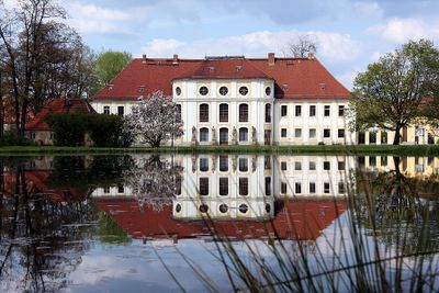
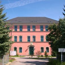
Schloss Königswartha, Cultural heritage castle in Königswartha, Germany
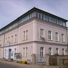
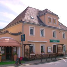
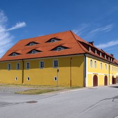
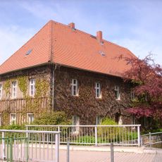
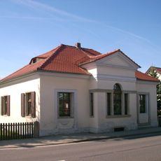
Schloss Königswartha is a two-story rectangular building with light-colored facades, fifteen window axes, and a rounded central projection on the garden side featuring a half-story addition. The structure now serves as a vocational school for fish farming and continues to function as an educational facility.
The castle originated as a royal watchtower in 1238 and was rebuilt between 1780 and 1796 in its current form for Count Johann Friedrich von Dallwitz. This transformation marked the shift from a defensive structure to an Enlightenment-era noble residence.
The entrance facade displays six statues from Balthasar Permoser's workshop, originally taken from Luga Castle and depicting figures from Greek mythology. These sculptures shape the character of the entrance and reflect artistic connections between regional noble residences.
The grounds are accessible daily, allowing visitors to view the architecture from outside and explore the surrounding park area. Access to the interior depends on school operations, so it is best to check ahead if you plan to visit inside.
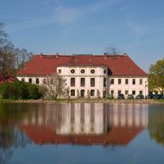
The castle is surrounded by an English landscape park with a pond whose water surface completely mirrors the garden facade. This reflection creates a special visual connection between the building and natural space that shifts with the time of day.
The community of curious travelers
AroundUs brings together thousands of curated places, local tips, and hidden gems, enriched daily by 60,000 contributors worldwide.