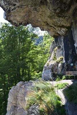
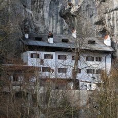
Luegsteinhöhle, Cave castle in Oberaudorf, Germany.
Luegsteinhöhle is a natural cave formation carved into limestone cliffs above Mühlbach village, situated at 610 meters elevation with a depth of roughly 23 meters. The opening provides views across the Inn Valley and into the surrounding mountain landscape.
Between the 10th and 13th centuries, this cave served as a fortified residence for the Lords of Lueg, who built a two-story wooden structure inside its chambers. Eventually they abandoned it and relocated to Burg Auerburg, leaving the cave largely unoccupied.
The name Luegstein comes from Germanic dialects meaning to look or observe, referring to how this elevated position commands views over the Inn Valley and surrounding peaks. Visitors today can still sense how this vantage point shaped the site's importance across the centuries.
Reaching the cave requires a 40-minute uphill walk from Luegsteinsee lake, with steep metal stairs and rope assistance for the final section of the ascent. The slope becomes slippery during rain, so sturdy footwear and careful footing are essential.
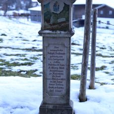
Local legend tells of Count von Auer seeking refuge in this cave to escape a prophecy of death by lightning, only to be struck down by a bolt at its entrance. This tale has persisted in regional lore for centuries and remains part of the site's identity today.
The community of curious travelers
AroundUs brings together thousands of curated places, local tips, and hidden gems, enriched daily by 60,000 contributors worldwide.