Rumpelbachschlucht
Rumpelbachschlucht, Natural monument in Winkelhaid, Germany
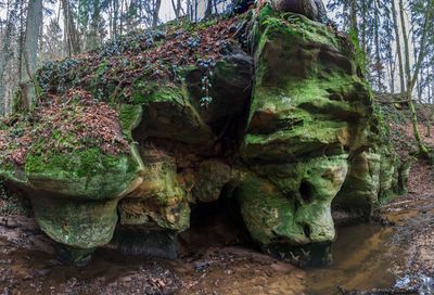
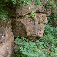
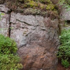
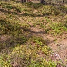
The gorge stretches 300 meters through sandstone formations with steep banks, featuring rock exposures and a small waterfall descending three meters over two steps.
The Röthenbach creek has carved through layers of Rhätsandstein and Oberen Feuerletten, forming geological structures dating back 200 million years to the Triassic period.
The Bavarian State Office for Environment registered this geological formation as a protected geotope under identifier 574R002, emphasizing its scientific importance.
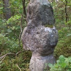
The unrestricted access path follows the creek from Röthenbach to the A6 motorway, requiring sturdy footwear due to occasional wooden walkways and water crossings.
The creek meanders through the valley beneath the gorge, creating distinct topographical features with sandstone walls reaching heights of five meters.
Location: Winkelhaid
Inception: 1939
Elevation above the sea: 395 m
Length: 300 m
Width: 100 m
GPS coordinates: 49.40494,11.33389
Latest update: March 5, 2025 16:49
Steinkreuz bei Röthenbach
847 m
Totenmaterl bei Weissenbrunn
2.4 km
Kreuz in Altdorf bei Nürnberg
597 m
Silbersandhöhle bei Hegnenberg
1.8 km
Station building at Altdorf bei Nürnberg station
2.3 km
Kreuz in Altdorf bei Nürnberg
1.3 km
Stall Ludersheimer Straße 17 (D-5-74-112-171#1)
1.9 km
Ehemaliges Amtsgericht in Altdorf bei Nürnberg
2.4 km
Ziegelhütter Hauptstraße 10
1.4 km
Ehemaliges Forstamt in Altdorf bei Nürnberg
2.3 km
Eichengruppe am Unteren Egelsee
1.5 km
An der Alten Ziegelhütte 7
1.4 km
Remise (Landwirtschaft) Röthenbacher Straße 12 (D-5-74-112-201#1)
539 m
Oberer Egelsee
1.1 km
Ehemaliges Wohnstallhaus in Altdorf bei Nürnberg
506 m
Wohnhaus in Altdorf bei Nürnberg
2.4 km
Cultural heritage monuments in Unterwellitzleithen
1 km
Wohnstallhaus in Altdorf bei Nürnberg
1.9 km
Wohnhaus in Altdorf bei Nürnberg
2.4 km
Steinbruch Lindenlohe bei Ungelstetten
1.6 km
Ehemaliges Wohnstallhaus in Altdorf bei Nürnberg
552 m
Bachaue des Röthenbachs östlich von Ungestetten
1 km
Die 2 Röthenbacher Angereichen
509 m
Wolfsgrube im gemeindefreien Gebiet Winkelhaid
1.2 km
Ehemaliges Wohnstallhaus in Altdorf bei Nürnberg
931 m
Ziegelhütter Hauptstraße 8
1.4 km
Remise (Landwirtschaft) Ludersheimer Straße 17 (D-5-74-112-171#2)
1.8 km
Wohnstallhaus in Altdorf bei Nürnberg
997 mReviews
Visited this place? Tap the stars to rate it and share your experience / photos with the community! Try now! You can cancel it anytime.
Discover hidden gems everywhere you go!
From secret cafés to breathtaking viewpoints, skip the crowded tourist spots and find places that match your style. Our app makes it easy with voice search, smart filtering, route optimization, and insider tips from travelers worldwide. Download now for the complete mobile experience.
A unique approach to discovering new places❞
— Le Figaro
All the places worth exploring❞
— France Info
A tailor-made excursion in just a few clicks❞
— 20 Minutes