Toten Berg, Mountain summit in Vorderer Vogelsberg, Germany.
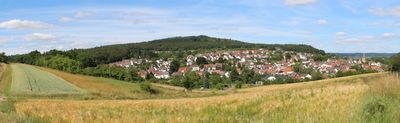
Toten Berg is a 357.5-meter summit in the Vorderer Vogelsberg near Gießen featuring basalt rock and loess deposits on its northern slopes. The geological composition shapes the visible landscape across the hillside and surrounding terrain.
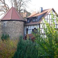
The summit shows traces of early human presence with stone tools from the Paleolithic period discovered through archaeological digs. A circular defensive structure from the Carolingian period indicates later occupation and the site's importance to medieval settlements.
The name connects to a medieval settlement called Totenhausen, with scholars linking it to personal names from that era. This shows how closely the region's geography became tied to the people who lived here long ago.
The L3146 road provides convenient access to the site and well-marked hiking trails run through the upper sections. Various routes suit different ability levels and allow visitors to explore the hill comfortably.
The hill sits within a protected landscape area established in 1964 that covers about 1.37 square kilometers and holds special value for bird conservation. Abandoned quarries on the eastern side have become breeding grounds for uncommon bird species.
The community of curious travelers
AroundUs brings together thousands of curated places, local tips, and hidden gems, enriched daily by 60,000 contributors worldwide.