Hoher Kopf, hill in Rhineland-Palatinate, Germany
Location: Rhineland-Palatinate
GPS coordinates: 49.22327,7.66382
Latest update: October 29, 2025 11:26
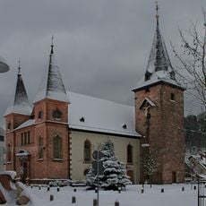
St. Maria (Rodalben)
3 km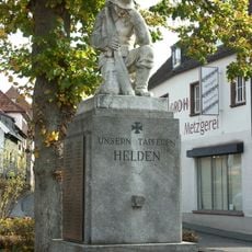
Kriegerdenkmal 1914/18
2.9 km
Ritterstein 298 "Am alten Glastaler Hof"
2.4 km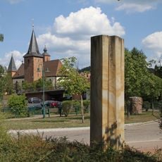
Veränderung
3.1 km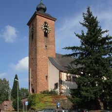
St. Josef (Rodalben)
2.9 km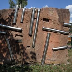
Geräusche der Stille
3 km
Work of art, sculpture
2.4 km
Blick Birkwiesertal
3.1 km
Zigeunerfelsen
2.7 km
Seibelsbachfelsen
2.2 km
Work of art
2 km
Work of art
3.1 km
Work of art, sculpture
2.7 km
Sculpture, Work of art
2.8 km
Fuchsfelsen
2.6 km
Blick auf Münchweiler
2.4 km
Saufelsen
2.3 km
Hoher Kopf Felsen
429 m
C1 Blick Burg Gräfenstein
3 km
Scenic viewpoint
2.3 km
Bruderfelsen
2.6 km
Erste Schuhfabrik
2.9 km
Kriegsdenkmal 1914-1918
3 km
Geburtshaus von Dr. Johann Peter Frank mit Dr.-Johann-Peter-Frank-Platz und Museum.
3.1 km
Memorial
3.1 km
Memorial stone, memorial
1.9 km
Memorial
2.9 km
Memorial, commemorative plaque
2.7 kmReviews
Visited this place? Tap the stars to rate it and share your experience / photos with the community! Try now! You can cancel it anytime.
Discover hidden gems everywhere you go!
From secret cafés to breathtaking viewpoints, skip the crowded tourist spots and find places that match your style. Our app makes it easy with voice search, smart filtering, route optimization, and insider tips from travelers worldwide. Download now for the complete mobile experience.

A unique approach to discovering new places❞
— Le Figaro
All the places worth exploring❞
— France Info
A tailor-made excursion in just a few clicks❞
— 20 Minutes