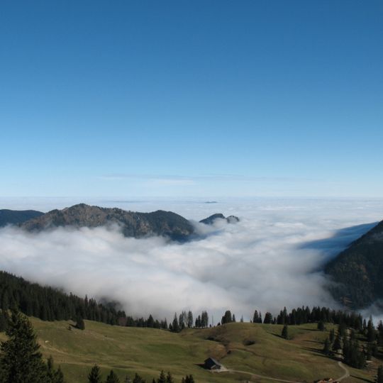
Kienberg, Mountain summit in the Tannheimer Mountains, Pfronten, Bavaria, Germany
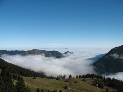
Kienberg is a mountain massif in the Tannheimer Mountains of the Allgäu Alps, about 3 km long and reaching 1536 m, on the municipal territory of Pfronten in Bavaria. Its main summit rises between the Achtal and Vilstal valleys, with the Schnalskopf secondary summit at 1452 m about 1 km to the east. The ridge is the northern boundary of the Tannheimer Mountains.
Kienberg has served as a natural landmark in this region since the formation of the Tannheimer Mountains during ancient Alpine mountain building. The peak has long been part of the local landscape and settlement patterns in Bavaria.
The Kienberg massif forms the northern boundary of the Tannheimer Berge, and its slopes above Pfronten-Dorf are used by walkers on the Waldpfad Im Ascha. The unofficial ridge path over the summit and the Schnalskopf is a route for experienced hikers, not a guided tradition. Refreshment stops nearby include the Milchhäusle and Fallmühle in Pfronten-Dorf, the Bärenmoosalpe and the Vilstalsäge in Pfronten-Ried.
The summit is reached by an unofficial path along the ridge, partly exposed with easy climbing sections and a steep ramp secured by a wire rope. It allows a traverse from Pfronten-Dorf to Himmelreich. Marked trails also circle the massif, such as the Waldpfad Im Ascha on the slope above Pfronten-Dorf. Nearby bases include the Milchhäusle and Fallmühle in Pfronten-Dorf, the Bärenmoosalpe and the Vilstalsäge in Pfronten-Ried.
The massif's highest point is 1536 m, with the 1452 m Schnalskopf as a secondary summit about 1 km to the east. An unofficial path crosses the whole ridge from Pfronten-Dorf to Himmelreich, including a steep ramp secured with a wire cable.
The community of curious travelers
AroundUs brings together thousands of curated places, local tips, and hidden gems, enriched daily by 94,400 contributors worldwide.