Ehem. Landhaus, building in Neubeuern, Upper Bavaria, Germany
Location: Neubeuern
Address: Rauwöhrstraße 18
GPS coordinates: 47.78377,12.14622
Latest update: November 13, 2025 09:30
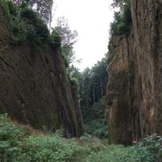
Wolfsschlucht
924 m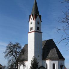
Hl. Dreifaltigkeit
717 m
Kapelle
615 m
Kapelle an der Samerstraße
893 m
Cultural heritage D-1-8238-0263 in Neubeuern
719 m
Mausoleum Am Bürgl 11 in Neubeuern
704 m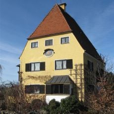
Eichendorffstraße 10
895 m
Friedhof Am Bürgl 15 in Neubeuern
692 m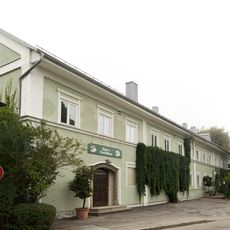
Rosenheimer Straße 8
929 m
Ehem. Bauernhaus
862 m
Friedhofsmauer Am Bürgl 15 in Neubeuern
710 m
Ehem. Bauernhaus
864 m
Gedenkstein zur Erinnerung an den Innübergang der französischen Rheinarmee am 8. Dezember 1800
766 m
Ehem. Bauernhaus
821 m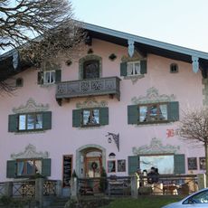
Samerstraße 50
761 m
Thansauer Straße 11
722 m
Samerstraße 48
775 m
Eichendorffstraße 3
797 m
Ehem. Bauernhaus
803 m
Ölbergkapelle Am Bürgl 11 in Neubeuern
713 m
Ehem. Bauernhaus
660 m
Wolfschlucht
878 m
Freilichtbühne
688 m
Wayside cross
848 m
Wayside cross
847 m
Wayside cross
803 m
Wayside cross
585 m
Übergangspunkt Reinarmee
764 mReviews
Visited this place? Tap the stars to rate it and share your experience / photos with the community! Try now! You can cancel it anytime.
Discover hidden gems everywhere you go!
From secret cafés to breathtaking viewpoints, skip the crowded tourist spots and find places that match your style. Our app makes it easy with voice search, smart filtering, route optimization, and insider tips from travelers worldwide. Download now for the complete mobile experience.

A unique approach to discovering new places❞
— Le Figaro
All the places worth exploring❞
— France Info
A tailor-made excursion in just a few clicks❞
— 20 Minutes