Stadel, bundwerkstadel mit Flachsatteldach, um Mitte 19. Jh
Location: Prien am Chiemsee
Address: Nähe Mupferting
GPS coordinates: 47.85141,12.30167
Latest update: November 14, 2025 12:44

Cultural heritage D-1-8139-0005 in Prien am Chiemsee
1.8 km
Cultural heritage D-1-8139-0010 in Riedering
1.1 km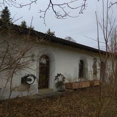
Ludwigstraße 52
1.9 km
Zugehöriger Getreidekasten
25 m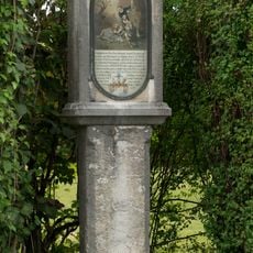
Bildstock
1.6 km
Scheune Munzing 5 in Prien am Chiemsee
437 m
Hofkapelle Latschenweg
1.4 km
Bildstock
910 m
Marienfigur
1.4 km
Wegkreuz
1.5 km
Feldkapelle
1.3 km
Geschnitzte Tür
1.5 km
Bauernhaus
1.2 km
Elektrizitätswerk Bachweg 4 in Prien am Chiemsee
2 km
Kapelle
913 m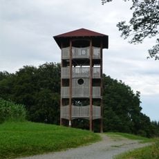
Ratzinger Höhe Observation Tower
1.9 km
Stadel
445 m
Wayside cross
1.7 km
Wayside cross
1.1 km
Wayside cross
659 m
Wayside cross
1.7 km
Wayside cross, Christianity
1.1 km
Wayside cross
405 m
Wayside cross
1.5 km
Wayside cross
1.1 km
Wayside cross
1.9 km
Wayside cross, Christianity
1.3 km
Wayside cross
1.2 kmReviews
Visited this place? Tap the stars to rate it and share your experience / photos with the community! Try now! You can cancel it anytime.
Discover hidden gems everywhere you go!
From secret cafés to breathtaking viewpoints, skip the crowded tourist spots and find places that match your style. Our app makes it easy with voice search, smart filtering, route optimization, and insider tips from travelers worldwide. Download now for the complete mobile experience.

A unique approach to discovering new places❞
— Le Figaro
All the places worth exploring❞
— France Info
A tailor-made excursion in just a few clicks❞
— 20 Minutes