
Untere Raineralm, blockbau, zum Teil verschindelt, vor die Blockwände zum Teil Mauern gelegt, 17./18. Jahrhundert
Location: Schliersee
Address: Südlich unter dem Rainerkopf beim Bodenschneidhaus in 1160 Metern Höhe
GPS coordinates: 47.68287,11.84650
Latest update: November 24, 2025 09:58
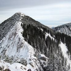
Brecherspitz
2 km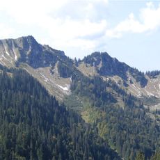
Bodenschneid
1.4 km
Wasserspitz
840 m
Rainerkopf
448 m
Dürnbachkapelle
1.8 km
Obere Raineralm
83 m
St. Leonhard
1.2 km
Freudenreichalm
756 m
Almhütte, obere Hütte der sogenannten Bodenalm
1.9 km
Almhütte, Obere Hütte der Niedeialm
2.3 km
Almhütte, sog. Sumperer Hütte der Niedeialm
2.3 km
Bildstock
1.6 km
Almhütte, untere Hütte der sogenannten Bodenalm
1.9 km
Almhütte Freudenreichalm in Schliersee (Gemeinde)
762 m
Almhütte Raineralm in Schliersee (Gemeinde)
100 m
WW1 & WW2
938 m
Suttenstein
2.2 km
Wayside cross
2.2 km
Wayside cross
1.8 km
Gedenktafel Oma Helga
2 km
Wayside shrine, Christianity
1.6 km
Birkenstein
1.4 km
SCA
1.3 km
Christianity, Catholic church building, wayside cross
2.2 km
Hansi Grimm
1.8 km
Wayside cross
1.5 km
Atanas Skatov
1.6 km
Waterfall
2.2 kmReviews
Visited this place? Tap the stars to rate it and share your experience / photos with the community! Try now! You can cancel it anytime.
Discover hidden gems everywhere you go!
From secret cafés to breathtaking viewpoints, skip the crowded tourist spots and find places that match your style. Our app makes it easy with voice search, smart filtering, route optimization, and insider tips from travelers worldwide. Download now for the complete mobile experience.

A unique approach to discovering new places❞
— Le Figaro
All the places worth exploring❞
— France Info
A tailor-made excursion in just a few clicks❞
— 20 Minutes