
Stadel und Getreidekasten eines Vierseithofs mit Windrad
Stadel und Getreidekasten eines Vierseithofs mit Windrad, satteldachbau, Blockbau mit Bundwerk, bezeichnet 1840;
Location: Bodenkirchen
Address: Dorfstraße 2
GPS coordinates: 48.41406,12.39682
Latest update: November 24, 2023 20:01
Cultural heritage D-2-7540-0015 in Bodenkirchen
660 m
St. Ulrich
1.5 km
Mariä Himmelfahrt
1.1 km
Schloss Bonbruck
1 km
Cultural heritage D-2-7540-0189 in Bodenkirchen
741 m
Cultural heritage D-2-7540-0172 in Bodenkirchen
1.3 km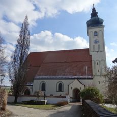
Katholische Pfarrkirche Ulrich von Augsburg
1.5 km
Hauskapelle
1.5 km
Cultural heritage D-2-7540-0016 in Bodenkirchen
1 km
Traidboden
1.7 km
Cultural heritage D-2-7540-0173 in Bodenkirchen
1.5 km
Stadel
319 m
Cultural heritage D-2-7540-0125 in Bodenkirchen
1.1 km
Pfarrhaus
1.5 km
Windrad Nähe Dorfstraße in Bodenkirchen
37 m
Kriegerdenkmal für die Gefallenen des Erster Weltkrieg und Zweiter Weltkrieg
1.3 km
Wegkreuz
904 m
Ehemaliges Kleinbauernhaus
1.7 km
Stadel
1.3 km
Wayside cross
1.4 km
Wayside cross
1.3 km
Memorial, war memorial
1.3 km
Schreinerkreuz
1.1 km
Kriegerdenkmal Bonbruck
1 km
Catholic church building, wayside cross, Christianity
1.6 km
Statue, Work of art
1 km
Wayside cross
1.7 km
Wayside cross
1.7 kmReviews
Visited this place? Tap the stars to rate it and share your experience / photos with the community! Try now! You can cancel it anytime.
Discover hidden gems everywhere you go!
From secret cafés to breathtaking viewpoints, skip the crowded tourist spots and find places that match your style. Our app makes it easy with voice search, smart filtering, route optimization, and insider tips from travelers worldwide. Download now for the complete mobile experience.

A unique approach to discovering new places❞
— Le Figaro
All the places worth exploring❞
— France Info
A tailor-made excursion in just a few clicks❞
— 20 Minutes