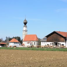
Stadel, stadel (Südflügel eines ehem. Vierseithofes), mit Traufbundwerk, Mitte 19. Jahrhundert
Location: Trostberg
Address: Dorfstraße 24
GPS coordinates: 48.04907,12.55049
Latest update: November 20, 2025 19:50
Katholische Kirche St. Thomas
1.5 km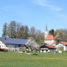
Katholische Filialkirche St. Nikolaus
179 m
Feldkapelle
1.3 km
Feldkapelle
1.8 km
Cultural heritage D-1-7941-0302 in Trostberg
180 m
Friedhofsmauer Kirchenweg 7 in Trostberg
180 m
Cultural heritage D-1-7941-0299 in Trostberg
1.5 km
Großer
1.8 km
Stallstadel Gainhartinger Straße 1 in Trostberg
1.6 km
Ehem. Kleinbauernhaus
256 m
Rinderstall Gainhartinger Straße 1 in Trostberg
1.5 km
Kleiner Einfirsthof
206 m
Vierseithof Schönharting 1 in Trostberg
1.8 km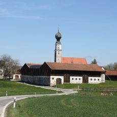
Stattlicher Vierseithof
1.6 km
Scheune Schönharting 1 in Trostberg
1.8 km
Stadel
1.5 km
Scheune Gainhartinger Straße 1 in Trostberg
1.5 km
Friedhofskapelle Tinninger Straße 3 in Trostberg
1.5 km
Sekundärer Parallelhof
379 m
Backhaus Gainhartinger Straße 1 in Trostberg
1.5 km
Vierseithof Schönharting 1 in Trostberg
1.8 km
Erneuertes Bauernhaus mit traufseitigem Bundwerk
1.8 km
Ehem. Bauernhaus
1.7 km
Scheune Perating 2 in Trostberg
401 m
Wayside cross
1.7 km
Wayside cross
1.5 km
Berndlmaier-Stein
1.1 kmReviews
Visited this place? Tap the stars to rate it and share your experience / photos with the community! Try now! You can cancel it anytime.
Discover hidden gems everywhere you go!
From secret cafés to breathtaking viewpoints, skip the crowded tourist spots and find places that match your style. Our app makes it easy with voice search, smart filtering, route optimization, and insider tips from travelers worldwide. Download now for the complete mobile experience.

A unique approach to discovering new places❞
— Le Figaro
All the places worth exploring❞
— France Info
A tailor-made excursion in just a few clicks❞
— 20 Minutes