
Ensemble Kreuzung Crailsheim- und Herzog-Friedrich-Straße
Ensemble Kreuzung Crailsheim- und Herzog-Friedrich-Straße, die Bebauung an der Kreuzung Crailsheim- und Herzog-Friedrich-Straße durch villenähnliche, von kleineren Gärten umgebene zweigeschossige Wohnhäuser ist ein exemplarischer Ausschnitt der im letzten Viertel des 19. Jahrhunderts einsetzenden Stadter
Location: Traunstein
Address: Traunstein
GPS coordinates: 47.86823,12.64093
Latest update: March 6, 2025 15:14

Äußere Rosenheimer Straße 21 (Traunstein)
487 m
Auferstehungskirche (Traunstein)
63 m
Alter Friedhof
266 m
Crailsheimstraße 17
149 m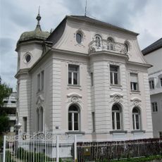
Marienstraße 10a Traunstein
284 m
Bachmayerstraße 1
405 m
Herzog-Friedrich-Straße 10a
26 m
Leonrodstraße 4a
197 m
Villenartiges Wohnhaus
444 m
Rosenheimer Straße 5 Traunstein
128 m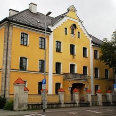
Maxplatz 8
391 m
Bahnhofstraße 16
289 m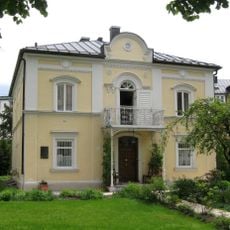
Villa Hager
251 m
Bahnhofstraße 32
150 m
Doppelwohnhaus
257 m
Herzog-Friedrich-Straße 8 Traunstein
64 m
Ludwigstraße 22
300 m
Crailsheimstraße 1
155 m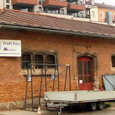
Ehemaliger Salzmühlstadel
376 m
Sommerkeller
287 m
Denkmal für Franz Xaver Gabelsberger
306 m
Bahnhofstraße 28
136 m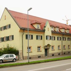
Ehemaliges Amtsgerichtsgebäude
380 m
Brothausturm
463 m
Wochinger-Keller
321 m
Bahnhofstraße 14
306 m
Haslacher Straße 18
241 m
Wohnhaus
397 mReviews
Visited this place? Tap the stars to rate it and share your experience / photos with the community! Try now! You can cancel it anytime.
Discover hidden gems everywhere you go!
From secret cafés to breathtaking viewpoints, skip the crowded tourist spots and find places that match your style. Our app makes it easy with voice search, smart filtering, route optimization, and insider tips from travelers worldwide. Download now for the complete mobile experience.

A unique approach to discovering new places❞
— Le Figaro
All the places worth exploring❞
— France Info
A tailor-made excursion in just a few clicks❞
— 20 Minutes