Traunstein, Administrative center in Bavaria, Germany
Traunstein serves as the administrative capital of its district in Upper Bavaria, located roughly halfway between Munich and Salzburg. The town sits on gently rolling terrain with views toward the nearby Chiemgau Alps, visible on clear days.
The settlement appears in written records for the first time in 1245 within documents from nearby Baumburg monastery. Town rights were granted in the early 1300s, allowing the community to develop as a regional hub for trade and administration.
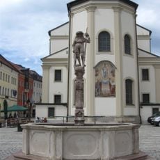
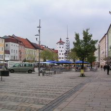
The name traces back to the Traun river that flows nearby, shaping the settlement from its earliest days. Locals gather around the central square during market days, where traders set up stalls and neighbors exchange news in a rhythm that has continued for centuries.
The town sits along a rail line that connects Munich and Salzburg, with trains running several times each day in both directions. Public services including hospitals, schools, and municipal offices are concentrated near the center and clearly marked with signs.
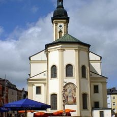
A large fire swept through the center in 1851, destroying most buildings and prompting a complete reconstruction funded partly by King Maximilian II. This rebuilding created a townscape with consistent mid-19th-century architecture, still visible along many streets today.
Location: Traunstein
Elevation above the sea: 591 m
Shares border with: Waging am See, Wonneberg, Surberg, Siegsdorf, Vachendorf, Grabenstätt, Chieming, Nußdorf, Traunreut
Address: 83278 Traunstein, Germany
Phone: +49861650
Website: https://traunstein.de
GPS coordinates: 47.86833,12.64333
Latest update: December 13, 2025 15:31
St. Oswald
350 mBurg Traunstein
534 m
Michael Traunstein
903 mRosenheimer Straße 2 Traunstein
102 m
Hochberg
3.2 km
St. Vitus und Anna
1.3 km
Traunstein arch railway bridge
679 m
Babalu Indoor Spielplatz
3.6 km
Salinenkapelle
369 m
Ehrensberg Observatory Traunstein
679 mKapuzinerkloster Traunstein
277 mKernschloss
833 m
Mariä Verkündigung (Haslach)
1.4 km
Lindlbrunnen
400 mBurgstall Traunstein
813 mCultural heritage D-1-8141-0174 in Grabenstätt
4.1 kmBurgstall Hochberg
3.1 kmBurgstall Lenzisburg
2.5 km
St. Stephan (Otting)
8.7 kmBurg Surberg
4.5 km
Ensemble Stadtplatz
432 m
Kapelle
4.1 km
Meilenstein von Erlstätt
4.8 km
Äußere Rosenheimer Straße 21 (Traunstein)
663 mBurgstall Tollberg
3.3 km
Tafernwirtschaft
4.8 kmDenkmal für Franz Xaver Gabelsberger (Traunstein)
323 mCultural heritage D-1-8141-0122 in Vachendorf
3.5 kmVisited this place? Tap the stars to rate it and share your experience / photos with the community! Try now! You can cancel it anytime.
Discover hidden gems everywhere you go!
From secret cafés to breathtaking viewpoints, skip the crowded tourist spots and find places that match your style. Our app makes it easy with voice search, smart filtering, route optimization, and insider tips from travelers worldwide. Download now for the complete mobile experience.
A unique approach to discovering new places❞
— Le Figaro
All the places worth exploring❞
— France Info
A tailor-made excursion in just a few clicks❞
— 20 Minutes