Kapelle, knall; mit Zeltdach, 18./19. Jahrhundert; beim unteren Hof
Location: Bavaria
Address: Knall
GPS coordinates: 47.90623,12.85585
Latest update: November 8, 2025 20:52
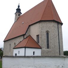
Maria Himmelfahrt
2.1 km
Lourdeskapelle
1.5 km
Feldkapelle zur Muttergottes von Altötting
1.5 km
Hofkapelle
225 m
Wegkapelle
1.3 km
Bauernhof Kirchhof 4 in Petting (Gemeinde)
2 km
Bauernhof Kirchhof 3; Kirchhof 5 in Petting (Gemeinde)
2.1 km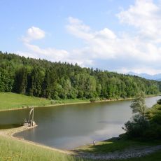
Uferbereiche des Waginger Sees, Götzinger Achen und untere Sur
1.7 km
Bauernhaus Zentern 1 in Petting (Gemeinde)
1.7 km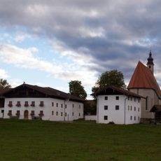
Kirchhof 5
2 km
Feldkreuz
1.6 km
Bauernhaus
1.8 km
Bauernhaus mit Widerkehr
1.5 km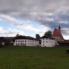
Ensemble Weiler Kirchhof
2.1 km
Bauernhaus mit Widerkehr
1.5 km
Bauernhaus
1.5 km
Bauernhaus Dorfen 6 in Laufen (Salzach)
1.6 km
Ehemaliges Bauernhaus
1.8 km
Ehemaliges Bauernhaus
1.8 km
Wohnteil eines Bauernhauses
1.2 km
Ukrainer Friedhof
946 m
Wayside cross
630 m
Wayside cross
1.2 km
Wayside shrine, Christianity
1.3 km
Wayside cross
1.6 km
Wayside cross
1.4 km
Wayside cross
1.2 km
Wayside cross
1.6 kmReviews
Visited this place? Tap the stars to rate it and share your experience / photos with the community! Try now! You can cancel it anytime.
Discover hidden gems everywhere you go!
From secret cafés to breathtaking viewpoints, skip the crowded tourist spots and find places that match your style. Our app makes it easy with voice search, smart filtering, route optimization, and insider tips from travelers worldwide. Download now for the complete mobile experience.

A unique approach to discovering new places❞
— Le Figaro
All the places worth exploring❞
— France Info
A tailor-made excursion in just a few clicks❞
— 20 Minutes