Kapelle, building in Pleiskirchen, Upper Bavaria, Germany
Location: Pleiskirchen
Address: Flur Klebing
GPS coordinates: 48.29902,12.59095
Latest update: November 19, 2025 02:01
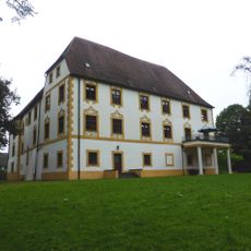
Schloss Klebing
211 m
Burgstall Dornberg
1.8 km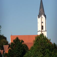
St. Nikolaus (Pleiskirchen)
968 m
Wegkapelle
936 m
Hofkapelle
613 m
Ortskapelle
1.9 km
Cultural heritage D-1-7641-0070 in Pleiskirchen
1.2 km
Cultural heritage D-1-7641-0022 in Pleiskirchen
602 m
Inschrifttafel Hofmark 3 in Pleiskirchen
980 m
Cultural heritage D-1-7641-0024 in Pleiskirchen
962 m
Wappentafel
280 m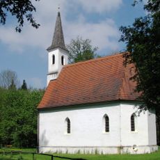
St. Ulrich
1.2 km
Ehemaliges Bauernhaus
1.8 km
Inschrifttafel
977 m
Cultural heritage D-1-7641-0069 in Pleiskirchen
2 km
Cultural heritage D-1-7741-0040 in Erharting
1.6 km
Ehemaliges Pfarrhaus
1 km
Friedhofsmauer Hofmark 1; In Pleiskirchen in Pleiskirchen
971 m
Cultural heritage D-1-7641-0063 in Pleiskirchen
211 m
Cultural heritage D-1-7641-0004 in Pleiskirchen
624 m
Cultural heritage D-1-7741-0037 in Erharting
1.8 km
Kleinbauernhaus
100 m
Golfplatz Pleiskirchen
1.8 km
Wayside shrine
1.3 km
Wayside shrine
7 m
Wayside cross
1.7 km
Wayside cross
1.3 km
Wayside cross
1.3 kmReviews
Visited this place? Tap the stars to rate it and share your experience / photos with the community! Try now! You can cancel it anytime.
Discover hidden gems everywhere you go!
From secret cafés to breathtaking viewpoints, skip the crowded tourist spots and find places that match your style. Our app makes it easy with voice search, smart filtering, route optimization, and insider tips from travelers worldwide. Download now for the complete mobile experience.

A unique approach to discovering new places❞
— Le Figaro
All the places worth exploring❞
— France Info
A tailor-made excursion in just a few clicks❞
— 20 Minutes