Stadel, fallthor; Südflügel des Vierseithofes, mit Bundwerk und alter Verschalung, zweites Viertel 19. Jahrhundert;
Location: Pleiskirchen
Address: Fallthor 1
GPS coordinates: 48.32758,12.66718
Latest update: November 24, 2023 20:01

Cultural heritage D-2-7642-0071 in Geratskirchen
1.5 km
Cultural heritage D-2-7641-0002 in Geratskirchen
1.2 km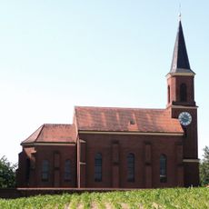
Katholische Pfarrkirche Maria Hilf
1.7 km
Kapelle, sogenannte ''Moserkapelle''
1.4 km
Cultural heritage D-2-7641-0033 in Geratskirchen
1.3 km
Bauernhof
1.7 km
Scheune Hub 4a in Pleiskirchen
818 m
Wohnstallhaus
1.5 km
Pfarrkirche
1.3 km
Ehemaliges Kleinbauernhaus
1.1 km
Nebengebäude Harpeting 2 in Pleiskirchen
1.5 km
Vierseithof
1.4 km
Nebengebäude Fallthor 1 in Pleiskirchen
24 m
Stadel
865 m
Bundwerkstadel
1.7 km
Bauernhaus
938 m
Nebengebäude Ruhnstetten 1 in Pleiskirchen
1.4 km
Dorfschmiede
1.3 km
Ehemaliges Bauernhaus
846 m
Scheune Harpeting 2 in Pleiskirchen
1.5 km
Stall Ruhnstetten 1 in Pleiskirchen
1.3 km
Friedhofsmauer Nähe Schuttgrube; Wald b.Winhöring 9 in Pleiskirchen
1.7 km
Scheune Ruhnstetten 1 in Pleiskirchen
1.3 km
Wayside cross
314 m
Wayside cross
164 m
Wayside cross
600 m
Wayside cross
1.3 km
Wayside cross
1.8 kmReviews
Visited this place? Tap the stars to rate it and share your experience / photos with the community! Try now! You can cancel it anytime.
Discover hidden gems everywhere you go!
From secret cafés to breathtaking viewpoints, skip the crowded tourist spots and find places that match your style. Our app makes it easy with voice search, smart filtering, route optimization, and insider tips from travelers worldwide. Download now for the complete mobile experience.

A unique approach to discovering new places❞
— Le Figaro
All the places worth exploring❞
— France Info
A tailor-made excursion in just a few clicks❞
— 20 Minutes