
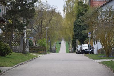
Former bridle-path, heute größtenteils Asphaltstraße, 3,5 km lange, vom Schlosshof nach Westen führende Wegachse, von Moritz Pedetti angelegt 1760/64
Location: Beilngries
Address: Hirschberg 70 a
GPS coordinates: 49.03641,11.45326
Latest update: September 23, 2025 16:44
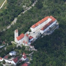
Hirschberg Castle
333 m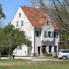
Former operating and residential building of Utzmuehle
1.3 km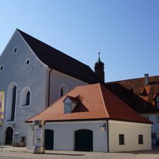
Former Franciscan Monastery
1.3 km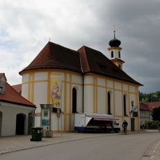
Saint Mary
1.3 km
Holy Trinity Chapel
836 m
Village chapel
290 m
Saint John's wayside shrine
471 m
Residential building
153 m
Gate tower
248 m
Former brewery of franciscan monastery
1.3 km
Ehemalige Steinbrüche am Hirschberg W von Beilngries
211 m
Sühnekreuz Kappenbauerweg
887 m
Castle chapel John the Evangelist
353 m
Former farmhouse
190 m
Wayside shrine
1.3 km
Monastery church St. Trinity
1.3 km
Ensemble former tax office
1.2 km
Former farmhouse
155 m
Former monastery guest house
1.3 km
Befestigungsturm der Vorburg
232 m
Defensive tower of the forecourt
187 m
Sauhüterturm
1.3 km
Defensive tower of the forecourt; coat of arms
143 m
Steinkreuz in Hirschberg
236 m
Bergfried
257 m
Boundary stone
779 m
Ensemble former episcopal brewery
789 m
Defensive tower of the forecourt
174 mReviews
Visited this place? Tap the stars to rate it and share your experience / photos with the community! Try now! You can cancel it anytime.
Discover hidden gems everywhere you go!
From secret cafés to breathtaking viewpoints, skip the crowded tourist spots and find places that match your style. Our app makes it easy with voice search, smart filtering, route optimization, and insider tips from travelers worldwide. Download now for the complete mobile experience.

A unique approach to discovering new places❞
— Le Figaro
All the places worth exploring❞
— France Info
A tailor-made excursion in just a few clicks❞
— 20 Minutes