
Stadel eines Dreiseithofs
Stadel eines Dreiseithofs, ständerbohlenstadel mit Flachsatteldach und Bundwerk, gegen Mitte 19. Jahrhundert; Querstadel, Flachsatteldachbau mit Blockbau- Obergeschoss (Getreidekasten) und Bundwerk, gegen Mitte 19. Jahrhundert
Location: Taufkirchen
Address: Grünau 1
GPS coordinates: 48.14537,12.41844
Latest update: November 21, 2025 21:16
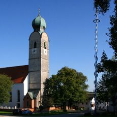
St. Andreas
1.8 km
Bildstock
1.3 km
Cultural heritage D-1-7840-0056 in Unterreit
1.8 km
Hütte
1.9 km
Windrad In Grünthal in Unterreit
1.8 km
Cultural heritage D-1-7840-0209 in Taufkirchen (Landkreis Mühldorf am Inn)
1.9 km
Cultural heritage D-1-7840-0207 in Taufkirchen (Landkreis Mühldorf am Inn)
297 m
Grünthal 9
1.9 km
St. Valentin
298 m
Stadel eines ehemaligen Vierseithofs
283 m
Kleinbauernhaus
1.8 km
St. Georg
1.9 km
Remise Grünthal 12 in Unterreit
1.8 km
Getreidekasten
333 m
Kapelle
1.5 km
Kapellenbildstock
986 m
Grünthal 4
1.9 km
Hofkapelle
1.9 km
Getreidekasten
1.9 km
Stadel
1.9 km
Scheune Grünthal 12 in Unterreit
1.8 km
Scheune Grünau 1 in Taufkirchen (Landkreis Mühldorf am Inn)
19 m
Wayside shrine
1.9 km
Wayside cross
1.8 kmReviews
Visited this place? Tap the stars to rate it and share your experience / photos with the community! Try now! You can cancel it anytime.
Discover hidden gems everywhere you go!
From secret cafés to breathtaking viewpoints, skip the crowded tourist spots and find places that match your style. Our app makes it easy with voice search, smart filtering, route optimization, and insider tips from travelers worldwide. Download now for the complete mobile experience.

A unique approach to discovering new places❞
— Le Figaro
All the places worth exploring❞
— France Info
A tailor-made excursion in just a few clicks❞
— 20 Minutes