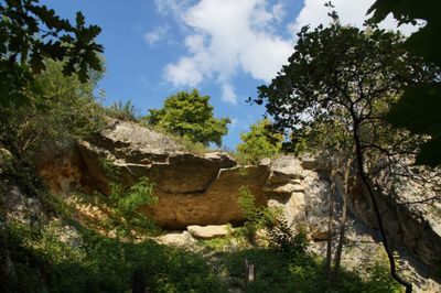
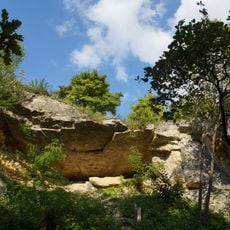
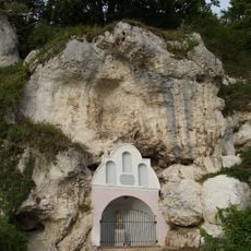
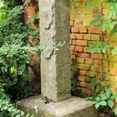
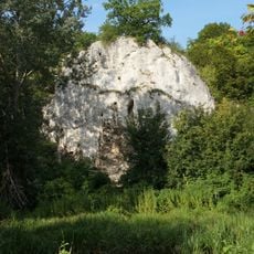
Schutzfelsen Pentling, Geotope and rocky wall in Pentling, Germany
Schutzfelsen Pentling is a rocky wall and geotope near Sinzing along the Danube River. The exposed rock face stretches about 20 meters long and 10 meters high at roughly 350 meters elevation, clearly showing the layered sequence between older limestone and younger greensandstone.
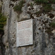
The site was first documented in 1854 by geologist Carl Wilhelm Gumbel, who studied the contact zone between Jurassic limestone and the Regensburg greensandstone formation. This discovery established it as a key reference point for the regional geological stratigraphy.
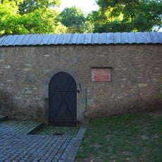
The site is marked by a memorial plaque installed by the Bavarian State Office for Monument Preservation, first placed in 1790 and renewed in 1890. This designation reflects how geologists value these rocks for understanding Earth's natural history.
The site is accessible via exit 45 Regensburg South on the A93 highway, followed by directional signs to Pentling. Information boards on-site explain the geological importance of this rock formation.
The sediments display an unusual color palette in bright red, violet, and blue tones, dotted with yellowish Lydite nodules and marcasite kernels. This uncommon mineral composition makes this exposure noteworthy among specialists.
The community of curious travelers
AroundUs brings together thousands of curated places, local tips, and hidden gems, enriched daily by 60,000 contributors worldwide.