
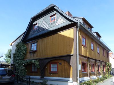
Dürningerstraße 15, Upper Lusatian house in Herrnhut
Location: Herrnhut
Address: Dürningerstraße 15
GPS coordinates: 51.01770,14.74480
Latest update: April 23, 2025 04:54
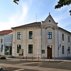
Herrnhut Museum of Ethnology
328 m
Kirchsaal
186 m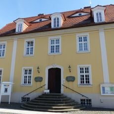
Heimatmuseum Herrnhut
169 m
Niedere Dorfstraße 12
1.7 km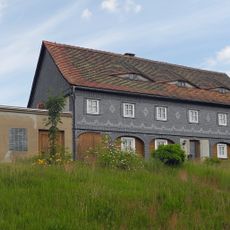
Hauptstraße 43
1.2 km
Herrnhut, Zisterne Comeniusstraße
191 m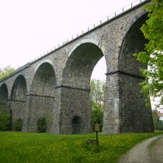
Einzeldenkmal der Sachgesamtheit Eisenbahn Löbau-Zittau: Eisenbahnviadukt über das Tal des Petersbaches (siehe auch Sachgesamtheitsliste - Obj. 09302439) (Petersbachtal, südwestlich vom Ort; km 44,504)
750 m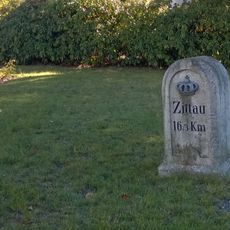
Kgl.-sächs. Postmeilenstein Löbauer Straße
340 m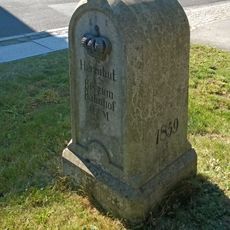
Royal Saxon milestone Comeniusstraße Herrnhut
179 m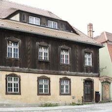
August-Bebel-Straße 9
102 m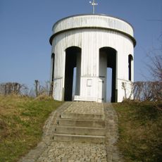
Hutberg-Altan Herrnhut
398 m
Hauptstraße 10
1.1 km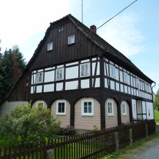
Hauptstraße 44
1.4 km
Eulkretscham
2.3 km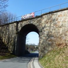
Eisenbahnbrücke Oderwitzer Straße
409 m
Hauptstraße 69
1.4 km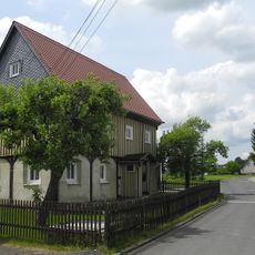
Südstraße 40
1 km
Südstraße 14
950 m
Südstraße 1
1.1 km
August-Bebel-Straße 11
95 m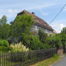
Schulstraße 21
1.6 km
Schulstraße 17; 19
1.6 km
Obere Dorfstraße 15
1.1 km
Obere Dorfstraße 8
1.1 km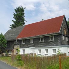
Obere Dorfstraße 3; 5
1.1 km
Grundschule; Berufsschule (ehem.); Schulgebäude Civitatenweg 8
415 m
Purzelgasse 18
2 km
Löbauer Straße 43
1.9 kmReviews
Visited this place? Tap the stars to rate it and share your experience / photos with the community! Try now! You can cancel it anytime.
Discover hidden gems everywhere you go!
From secret cafés to breathtaking viewpoints, skip the crowded tourist spots and find places that match your style. Our app makes it easy with voice search, smart filtering, route optimization, and insider tips from travelers worldwide. Download now for the complete mobile experience.

A unique approach to discovering new places❞
— Le Figaro
All the places worth exploring❞
— France Info
A tailor-made excursion in just a few clicks❞
— 20 Minutes