
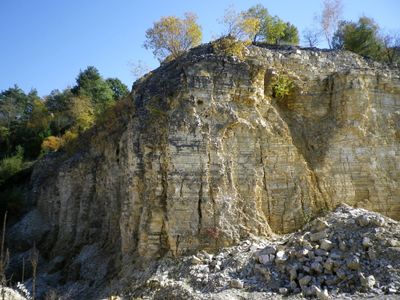
Ehemaliger Steinbruch W von Ettling, Geotop in Landkreis Eichstätt in Bavaria, Germany
Location: Pförring
Elevation above the sea: 370 m
Length: 150 m
Width: 30 m
Website: http://www.umweltatlas.bayern.de/mapapps/resources/reports/geotope/generateBericht.pdf?additionallayerfieldvalue=176A033
GPS coordinates: 48.81714,11.65870
Latest update: March 8, 2025 03:07
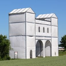
Castrum Celeusum
1.7 km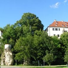
Schloss Wackerstein
3.3 km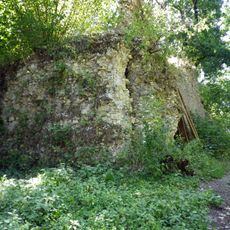
Burgruine Ettling
220 m
Sankt Leonhard
2.5 km
Cultural heritage D-1-7135-0183 in Pförring
318 m
St. Stephanus
4 km
Filialkirche St. Michael
3 km
St. Maria Magdalena
2.4 km
St. Peter und Paul (Mindelstetten)
2.3 km
St. Gertraud
3.1 km
St. Margaretha
1.9 km
Pfarrkirche St. Nikolaus (Mindelstetten)
3.8 km
Kapelle
4.1 km
St. Stephan
2.6 km
St. Sebastian
2.5 km
Altöttinger Kapelle
3.7 km
Katholische Filialkirche Mariae Himmelfahrt
2.7 km
Bauernhaus
2.2 km
Kastell Pförring
1.8 km
Gasthaus
2.4 km
Bauernhof
2.3 km
Donauauen zwischen Ingolstadt und Weltenburg
1.2 km
Anna-Schäffer-Geburtshaus
3.9 km
Wohn- und Geschäftshaus
2.3 km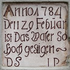
Inschrifttafel
2.5 km
Pfarrhaus
2.5 km
Gasthof
2.4 km
Ehemaliger Bauernhof
2.2 kmReviews
Visited this place? Tap the stars to rate it and share your experience / photos with the community! Try now! You can cancel it anytime.
Discover hidden gems everywhere you go!
From secret cafés to breathtaking viewpoints, skip the crowded tourist spots and find places that match your style. Our app makes it easy with voice search, smart filtering, route optimization, and insider tips from travelers worldwide. Download now for the complete mobile experience.

A unique approach to discovering new places❞
— Le Figaro
All the places worth exploring❞
— France Info
A tailor-made excursion in just a few clicks❞
— 20 Minutes