
Holzhauser Wald bei Türkismühle, protected area in the European Union defined by the habitats directive in Saarland, Germany
Location: Nohfelden
Inception: 2000
GPS coordinates: 49.59473,7.09730
Latest update: November 20, 2025 01:27
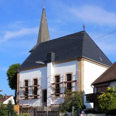
Evangelische Kirche
2.3 km
St. Ignatius
1.6 km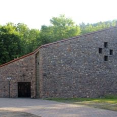
Evangelische Kirche
1.7 km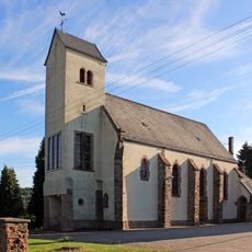
Rosenkranzkönigin
2.8 km
Holzhauser Wald bei Türkismühle
604 m
Große Höhe
2 km
Landschaftsschutzgebiet "Rothenberg" (L-6308-304)
2.7 km
Landschaftsschutzgebiet im Landkreis St. Wendel - in der Gemeinde Nohfelden
852 m
Rothen-Berg
2.7 km
Landschaftsschutzgebiet "Söterbachtal" (L 6408-302)
2 km
Landschaftsschutzgebiet "Felsental der Nahe bei Nohfelden" (L 6308-303)
2.9 km
Danken-Berg
2.6 km
Kellerberg
2.6 km
Rothenberg
2.3 km
Felsental der Nahe bei Nohfelden
2.9 km
Söterbachtal
1.5 km
Wayside cross
3 km
Attraktionen Bogenschießen
3 km
Laser Battle Outdoor
3.1 km
Aqua Mundo
2.9 km
Kinderbauernhof
3.1 km
Ruins
1.6 km
Cave entrance
2.9 km
Memorial
2 km
Stolperstein, memorial
2.1 km
Stolperstein, memorial
2.1 km
Stolperstein, memorial
2.1 km
Stolperstein, memorial
2.1 kmReviews
Visited this place? Tap the stars to rate it and share your experience / photos with the community! Try now! You can cancel it anytime.
Discover hidden gems everywhere you go!
From secret cafés to breathtaking viewpoints, skip the crowded tourist spots and find places that match your style. Our app makes it easy with voice search, smart filtering, route optimization, and insider tips from travelers worldwide. Download now for the complete mobile experience.

A unique approach to discovering new places❞
— Le Figaro
All the places worth exploring❞
— France Info
A tailor-made excursion in just a few clicks❞
— 20 Minutes